
Short Answer
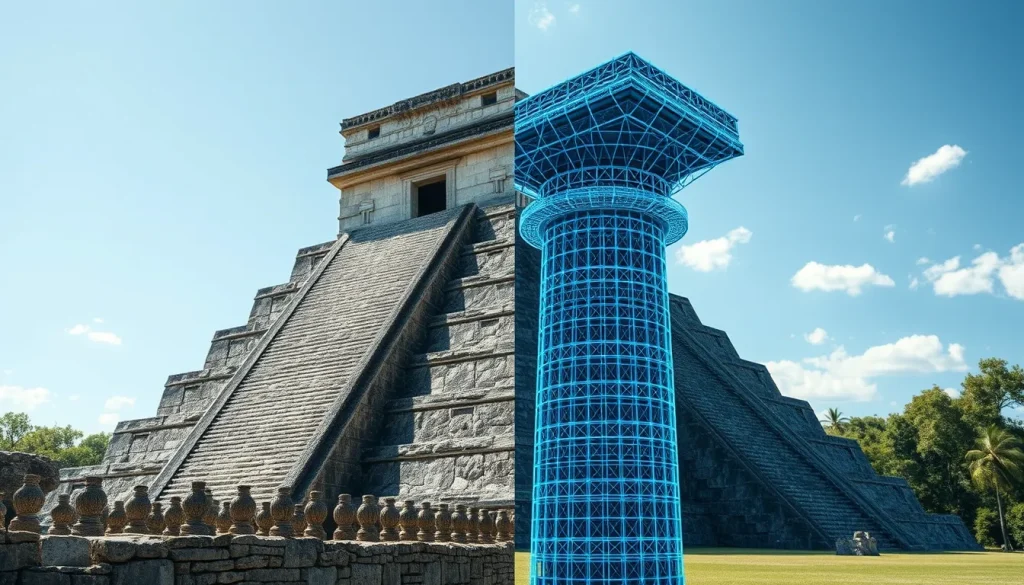
The question of whether we can accurately reconstruct ancient Maya buildings lies at the intersection of traditional archaeology and modern digital heritage science. For over a century, archaeologists have struggled with the decay of organic materials, the collapse of vaulted ceilings, and the overgrowth of vegetation that obscures architectural intent. Today, the answer is nuanced: while physical reconstruction is often restricted to preserve authenticity, virtual reconstruction using high-fidelity digital data has reached a level of precision that allows scholars to test structural hypotheses with unprecedented accuracy.
Main Explanation
Accurate reconstruction in Maya archaeology does not necessarily mean rebuilding stone upon stone in the physical world. Instead, it refers to the creation of data-driven models that reflect the building’s original form based on available evidence. This process involves synthesizing archaeological remains, iconographic data, and ethnographic analogies. The goal is to understand the spatial experience, structural integrity, and astronomical alignment of the structures as they existed during the Classic and Postclassic periods.
Physical reconstruction is governed by strict conservation charters, such as the Venice Charter, which prioritize stabilization over restoration. Consequently, digital reconstruction has become the primary vehicle for exploring “what if” scenarios. By utilizing terrestrial laser scanning (TLS) and structure-from-motion (SfM) photogrammetry, researchers can capture millions of data points from existing fragments. These point clouds serve as the foundation for virtual models that can be manipulated to test load-bearing capacities, sightlines, and acoustic properties without risking the integrity of the ancient masonry.
Evidence & Sources
The evidence supporting accurate digital reconstruction comes from multiple pillars of archaeological inquiry. First, the architectural remains themselves provide the primary data. Even collapsed structures retain geometric information in their fallen blocks. Second, iconographic evidence, such as murals and carved stelae, often depicts buildings in their complete state, offering clues about roof combs and facade decorations. Third, recent advancements in digital documentation have created permanent records of sites that are vulnerable to climate change and tourism impacts.
Significant projects have demonstrated the viability of this approach. For instance, the Mausoleum Architectural Project reinterpreted Palenque’s Temple of the Inscriptions through 3D data-driven architectural analysis, published in Ancient Mesoamerica in 2021. Similarly, comprehensive digital documentation of the Satunsat labyrinth at Oxkintok utilized TLS and SfM to assess structural stability and document interior spaces that are difficult to access. These projects prove that digital surrogates can serve as reliable proxies for physical analysis.
Deep Dive Analysis
Module F: Digital Archaeology
Technology Description
Digital archaeology in the Maya region relies heavily on remote sensing and close-range imaging. The core technologies include Terrestrial Laser Scanning (TLS), which uses laser beams to measure distances to surfaces, and Structure-from-Motion (SfM) photogrammetry, which generates 3D models from overlapping 2D photographs. Unmanned Aerial Vehicles (UAVs) equipped with LiDAR sensors are also used for regional landscape analysis, though close-range TLS is preferred for architectural reconstruction.
How It Works
The process begins with data acquisition. Scanners are positioned at multiple stations around a structure to ensure full coverage, minimizing occlusions where data might be missed. Simultaneously, high-resolution photographs are taken with calibrated cameras. The software aligns these images and point clouds into a unified coordinate system. This creates a mesh—a digital skin over the data points—which can then be textured using the photographic imagery.
Field Workflow
Fieldwork requires meticulous planning. At sites like Chichén Itzá, researchers must coordinate with local authorities, such as the Instituto Nacional de Antropología e Historia (INAH). The workflow involves setting up control points with known GPS coordinates to georeference the data. Once scanned, the data is processed in laboratories where noise is filtered, and separate scans are registered together. This workflow was exemplified in the 2016 documentation of Satunsat at Oxkintok, where interior vaulted passageways were mapped across three levels.
Output/Data
The primary output is a metrically accurate 3D model, often accompanied by orthophotos and elevation maps. These datasets allow for precise measurements of stone cuts, vault angles, and plaza dimensions. In 2025, a team led by Scott McAvoy and colleagues published a digital reconstruction of a serpent column at Chichén Itzá’s El Castillo. By analyzing fragments, they were able to digitally reassemble the column, providing insights into its original height and iconographic program without physically moving the fragile stones.
Example
A prime example of accuracy is the work done at the Temple of the Inscriptions in Palenque. The Mausoleum Architectural Project used 3D data to analyze the internal stress of the building. This allowed architects to understand how the Maya builders distributed weight across the corbelled arches. The digital model revealed construction phases that were not visible to the naked eye, demonstrating how data-driven analysis can uncover hidden architectural histories.
Strengths
The primary strength of digital reconstruction is non-invasiveness. Researchers can “excavate” virtually, removing vegetation or collapse debris in the model to see underlying structures. It also facilitates collaboration; a model created in Mexico can be studied by engineers in Europe or the United States. Furthermore, these models serve as preservation records. If a structure is damaged by natural disasters, the digital twin remains as a permanent record of its state prior to the event.
Limitations
Despite advancements, limitations exist. Digital models are only as accurate as the data input. Occlusions, such as the undersides of vaults or spaces blocked by modern protective shelters, may remain unscanned. Additionally, reconstruction often requires interpretation. While the stone positions might be known, the original plaster colors or wooden lintels—which rarely survive—must be inferred from other sites or historical accounts, introducing a degree of speculation.
Accuracy
Geometric accuracy in modern TLS can reach sub-millimeter levels. However, interpretive accuracy varies. Structural reconstructions based on physics engines are highly reliable, while aesthetic reconstructions (such as paint schemes) are more hypothetical. The 2022 study “Digitizing an Excavation” highlighted the creation of laser scanning databases for Maya architectural remains, emphasizing that standardization of data is crucial for maintaining long-term accuracy and comparability across different sites.
Cultural Heritage Considerations
Digital reconstruction must respect the cultural significance of the sites to descendant communities. In Mexico, INAH maintains strict control over data dissemination to prevent misuse. There is also an ethical consideration regarding “virtual tourism.” While it increases access, it must not replace the incentive to protect the physical site. Researchers argue that digital models should complement physical conservation, not substitute for the stewardship of the actual heritage assets.
FAQ
Is virtual reconstruction considered scientifically valid?
Yes, when based on empirical data such as laser scans and archaeological context, virtual reconstruction is a valid method for testing hypotheses without damaging original structures.
Why not physically rebuild the buildings?
International conservation ethics prioritize preservation over restoration. Physical rebuilding can destroy historical evidence and compromise the authenticity of the site.
How accurate are the digital models?
Geometric accuracy can reach sub-millimeter levels using terrestrial laser scanning, though interpretive elements like color or wood require historical inference.
Who controls the data from these scans?
In Mexico, the Instituto Nacional de Antropología e Historia (INAH) regulates access to archaeological data to ensure cultural heritage protection.
Leave a Reply