
Short Answer
Determining the chronology of ancient Maya structures has traditionally relied on invasive excavation methods, which often compromise the integrity of archaeological sites. However, modern advancements in digital heritage and geochemical analysis have revolutionized this process. Archaeologists can now date Maya structures without invasive excavation by employing remote sensing technologies and minimally destructive material analysis. These approaches allow researchers to understand the history and spread of settlement on a larger scale than ever before recorded, preserving the physical fabric of the ruins for future generations while answering critical questions about Maya civilization timelines.
Main Explanation
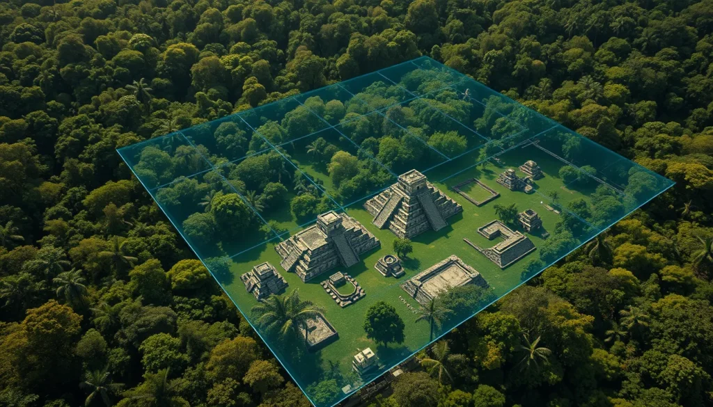
The primary challenge in dating Maya architecture lies in accessing organic materials or stratigraphic layers without dismantling the structures themselves. Traditional methods require digging test pits or removing stucco layers, which can damage historic masonry. Contemporary non-invasive or minimally invasive strategies focus on two main avenues: remote sensing via Light Detection and Ranging (LiDAR) and the radiocarbon or archaeomagnetic dating of architectural mortar. LiDAR technology provides highly accurate, detailed 3-D maps of ground surface topography, allowing archaeologists to identify structural sequences and landscape alterations without clearing vegetation. Meanwhile, the analysis of lime mortars used in construction offers a direct dating mechanism. Since Maya mortar often contains charcoal from the fuel used to burn limestone during production, radiocarbon dating of these inclusions can pinpoint the construction date. Additionally, archaeomagnetic dating analyzes the magnetic properties locked into the mortar when it cooled, providing another chronological marker.
These methods complement each other. LiDAR identifies the scope and layout of settlements, such as the ancient site of Ceibal in Guatemala, while mortar analysis provides specific dates for construction phases. This combination reduces the need for extensive trenching. For instance, research in the Quintana Roo region has demonstrated the viability of radiocarbon dating on architectural mortar, validating it as a case study for the broader Maya region. By integrating these techniques, archaeologists minimize physical impact while maximizing data recovery, aligning with modern ethical standards in cultural heritage management.
Evidence & Sources
Empirical evidence supporting these non-invasive methods comes from several key studies conducted across the Maya lowlands. A foundational study by Jennifer P. Mathews from Trinity University examined radiocarbon dating of architectural mortar in the Quintana Roo region of Mexico. Published in the Journal of Field Archaeology in 2001, this research established that charcoal embedded within the mortar matrix could be reliably dated to determine when the structure was built. This method bypasses the need for associated organic remains like wood or bone, which are not always present in masonry contexts.
Further evidence is found in the work of Luisa Straulino Mainou and colleagues, who investigated Maya lime mortars at Dzibanché. Their research highlighted the relationship between archaeomagnetic dating, manufacturing technique, and architectural function. By analyzing the magnetic signatures preserved in the lime, they could correlate construction events with specific historical periods without extensive demolition. On the remote sensing front, a team led by University of Arizona professor Takeshi Inomata utilized airborne laser mapping technology at Ceibal, Guatemala. Published in 2018, their work demonstrated how LiDAR could map a significantly larger area than ever before recorded in just a few days. The technology penetrated the forest canopy to reveal anthropogenic landscape alterations, proving that settlement history could be explored on a regional scale without ground disturbance. These sources collectively validate the shift toward digital and chemical analysis over traditional excavation.
Deep Dive Analysis
Technology Description
LiDAR (Light Detection and Ranging) is an active remote sensing system that uses laser pulses to measure distances to the Earth’s surface. In the context of Maya archaeology, it is mounted on aircraft to scan large areas of jungle-covered terrain.
How It Works
The system emits rapid laser pulses toward the ground. Some pulses reflect off the forest canopy, while others penetrate gaps to reach the ground surface. By measuring the time it takes for the light to return, the system calculates precise elevations. This process filters out vegetation to create a digital elevation model of the bare earth.
Field Workflow
The workflow begins with mission planning to cover the target area, such as the Ceibal site. A small airplane equipped with lasers flies over the region. Data is collected over the course of just a few days, significantly faster than ground surveying. The raw data is then processed to remove noise and vegetation points.
Output/Data
The primary output is a highly accurate, detailed 3-D map of ground surface topography. These maps reveal structures, causeways, and terraces that are invisible from the ground due to dense vegetation. The data allows for the analysis of anthropogenic landscape alterations as a component of the built environment.
Example
A prominent example is the mapping of Ceibal in Guatemala by Inomata and colleagues. They commissioned the use of LiDAR to explore the history and spread of settlement. The technology allowed them to record a significantly larger area than ever before, revealing the extent of the ancient city without cutting down trees or digging.
Strengths
The primary strength is the ability to survey large scales efficiently. It provides a comprehensive view of settlement patterns and landscape modification. It is non-destructive, preserving the site for future study. It also identifies targets for limited, focused excavation rather than broad trenching.
Limitations
LiDAR cannot provide absolute dates on its own; it requires ground truthing or complementary dating methods like mortar analysis. Dense vegetation can sometimes obscure fine details if the canopy is too thick. The technology is also costly and requires specialized equipment and expertise to process the data.
Accuracy
LiDAR provides highly accurate topographic data, often within centimeters of vertical accuracy. This precision allows archaeologists to distinguish between natural hills and constructed platforms. When combined with mortar dating, the chronological accuracy improves significantly.
Cultural Heritage Considerations
Non-invasive methods align with contemporary heritage ethics that prioritize preservation. By reducing the need for excavation, these technologies protect the physical structure from weathering and damage caused by exposure. They also respect indigenous land rights by minimizing physical intrusion into sacred or protected landscapes.
FAQ
Can LiDAR date structures directly?
No, LiDAR maps topography and structure location. Dating requires complementary methods like mortar analysis.
Why is mortar useful for dating?
Maya mortar contains charcoal from the fuel used to burn limestone, which can be radiocarbon dated.
Is excavation completely avoided?
Not always, but these methods significantly reduce the need for invasive digging by targeting specific areas.





Leave a Reply