
Short Answer
The preservation of cultural heritage faces unprecedented challenges in the modern era, ranging from climate change and pollution to armed conflict and natural decay. Across 163 different countries, approximately 1,000 natural and cultural historic places constitute humanity’s most precious heritage, designated as UNESCO World Heritage Sites. However, significant sites such as the Buddhas of Bamiyan in Afghanistan and the ancient city of Palmyra in Syria have already suffered partial or total destruction. The financial resources allocated for physical preservation, such as the $4 million a year that UNESCO allocates, are not nearly enough to protect even the sites considered at imminent risk. In response to these critical threats, 3D archaeology has emerged as a vital discipline, leveraging digital technologies to hold on to heritage virtually through 3D scanning, modeling, and reconstruction.
Main Explanation
3D archaeology, often referred to as digital archaeology, represents a transformative shift from traditional analog recording systems to modern digital ecosystems. This field integrates advanced computational and three-dimensional technologies to enable highly accurate, non-invasive documentation of archaeological sites and artifacts. The core objective is to minimize the destructive nature of excavation while maximizing the data retained for future study. By creating precise digital twins of physical objects and landscapes, archaeologists can analyze structures without physical contact, share data globally, and reconstruct sites that may be lost to time or conflict.
The advancement of digital technologies such as photogrammetry, 3D scanning, Geographic Information Systems (GIS), and image processing has standardized these practices. Photogrammetry involves generating 3D models from overlapping photographs, while LiDAR (Light Detection and Ranging) uses laser pulses to map surfaces with high precision. Structured light scanning offers another layer of detail for smaller artifacts. These technologies are not merely recording tools; they are interpretive instruments that allow researchers to visualize spatial relationships, structural integrity, and historical evolution in ways previously impossible. The integration of Artificial Intelligence (AI), Virtual Reality (VR), and Augmented Reality (AR) further enhances the interpretive potential, allowing both scholars and the public to engage with heritage in immersive environments.
Evidence & Sources
Recent academic literature underscores the rapid evolution and necessity of these technologies. According to Flor-Unda et al. (2026), the reconstruction of archaeological evidence with digital technologies is characterized by emerging trends in 3D surveying and cultural heritage protection. Their research highlights the importance of image processing and 3D reconstruction in safeguarding archaeological research. Similarly, Ansari and Talha examine the evolution of digital archaeology, emphasizing how these technologies enable non-invasive documentation. Their study places particular emphasis on major case studies, including the reconstruction of Notre-Dame Cathedral and virtual restoration projects, demonstrating the practical application of these tools in high-profile preservation efforts.
Scientific American reported as early as 2016 that new digital-conservation technologies allow us to preserve endangered historic sites forever in 3D digital libraries. This assertion is supported by the ongoing digitization of ruined architecture, where IT strategies are employed to interpret and valorize sites that might otherwise remain inaccessible or degraded. The consensus among researchers is that while physical preservation is ideal, digital preservation offers a fail-safe mechanism against total loss. The documentation created serves as a permanent record, ensuring that even if the physical structure is damaged, the data remains available for future reconstruction or study.
Deep Dive Analysis
Technology Description
Digital archaeology encompasses a suite of technologies designed to capture spatial data. The primary tools include photogrammetry, which uses software to stitch together hundreds of photographs into a textured 3D mesh, and LiDAR, which penetrates vegetation to reveal underlying structures. GIS is used to manage spatial data layers, while AI assists in pattern recognition and automated modeling. These tools work in concert to create a comprehensive digital ecosystem around a heritage site.
How It Works
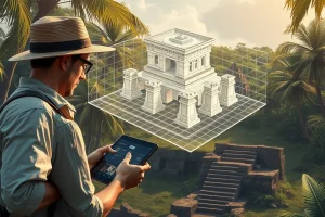
The process begins with data acquisition. For photogrammetry, cameras capture images from multiple angles with significant overlap. For LiDAR, a scanner emits laser pulses that reflect off surfaces, measuring distance based on time of flight. This raw data is then processed using specialized software to generate point clouds, which are converted into mesh models. Textures are mapped onto these models to create photorealistic representations. The final output is a digital asset that can be measured, analyzed, and viewed in virtual environments.
Field Workflow
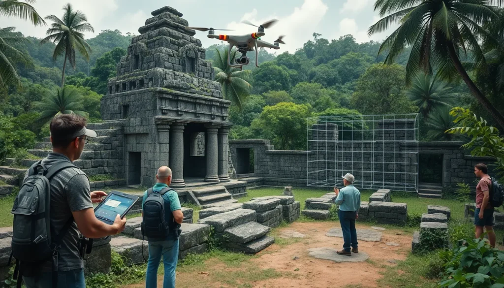
Fieldwork requires meticulous planning. Researchers must establish control points for georeferencing to ensure accuracy. Drones are often employed for aerial photogrammetry, while terrestrial scanners handle ground-level details. The workflow involves capturing data, backing it up immediately, and processing it in stages. Quality control is essential at every step to ensure that the digital model accurately reflects the physical reality. This workflow minimizes the time spent on-site, reducing the risk of damage to fragile contexts.
Output and Data
The primary outputs are 3D models, orthophotos, and digital elevation models. These files can be stored in digital libraries, making them accessible to researchers worldwide. The data allows for precise measurements of architectural features, monitoring of degradation over time, and virtual restoration. For example, changes in a structure’s geometry can be detected by comparing models scanned years apart, providing critical data for conservation management.
Example
A prominent example of this technology in action is the reconstruction of Notre-Dame Cathedral following the 2019 fire. Digital records created prior to the disaster were instrumental in planning the restoration. Similarly, virtual restoration efforts have been applied to sites like Palmyra, where ISIS destruction obliterated ancient monuments. Digital models allow these sites to be experienced virtually, preserving their memory even if physical reconstruction is delayed or impossible.
Strengths
The strengths of 3D archaeology include non-invasiveness, high accuracy, and permanence. It allows for the documentation of sites that are too dangerous to access physically. It also facilitates public engagement through VR and AR, democratizing access to heritage. Furthermore, it provides a baseline for monitoring environmental impacts, such as erosion or pollution, enabling proactive conservation measures.
Limitations
Despite its advantages, the technology has limitations. High-quality scanning equipment can be expensive, creating barriers for researchers in developing nations. Data storage requirements are significant, as high-resolution models consume vast amounts of space. Additionally, digital models are interpretations of reality; they rely on the quality of the input data and the algorithms used to process them. There is also the risk of digital obsolescence, where file formats become unreadable over time.
Accuracy
Accuracy depends on the equipment and methodology used. LiDAR can achieve millimeter-level precision, while photogrammetry varies based on camera resolution and lighting conditions. Ground control points are essential for georeferencing models to real-world coordinates. Validation against physical measurements is often required to ensure the digital model meets scientific standards for archaeological recording.
Cultural Heritage Considerations
Ethical considerations are paramount in digital archaeology. Communities must be consulted regarding the scanning and sharing of sacred sites. There is a risk that digital models could be used for unauthorized commercial purposes or could facilitate looting by revealing hidden details. Therefore, data management policies must balance open access with cultural sensitivity and security. The goal is to empower local communities and preserve heritage for future generations without compromising its integrity or sacredness.
FAQ
What is the primary benefit of 3D archaeology over traditional methods?
The primary benefit is non-invasive documentation that creates permanent digital records without damaging the site, allowing for virtual restoration and analysis even if the physical site is destroyed.
How does LiDAR help in archaeological surveys?
LiDAR uses laser pulses to map surfaces with high precision, often penetrating vegetation to reveal underlying structures that are invisible to the naked eye or standard photography.
Can digital models replace physical preservation?
No, digital models serve as a backup and research tool. They preserve the memory and data of a site but cannot replace the cultural and physical value of the original structure.
What threats do UNESCO World Heritage Sites face?
Sites face threats from war, climate change, pollution, wind, and rain, with some sites like Palmyra and the Buddhas of Bamiyan already partially or totally destroyed.
Leave a Reply