
Short Answer
The integration of laser scanning technology into archaeological practice represents a paradigm shift in how researchers record, analyze, and preserve cultural heritage. Traditionally, archaeological documentation relied on direct survey methods involving pencils, paper, and tape measures, which were time-consuming and prone to subjective human error. Today, indirect techniques such as Terrestrial Laser Scanning (TLS) and Airborne LiDAR allow for the rapid acquisition of precise spatial data. This transition enables the creation of comprehensive digital archives that capture the geometry and texture of sites with unprecedented fidelity, ensuring that even if a physical site is lost to erosion, conflict, or development, its digital counterpart remains for future study.
Main Explanation
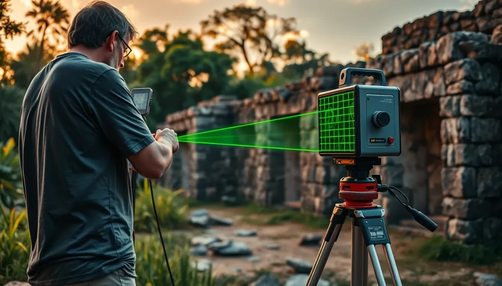
Laser scanning in archaeology functions by emitting laser pulses toward a target and measuring the time it takes for the light to return to the sensor. This process, known as Time of Flight or phase-shift measurement, generates a dense collection of spatial coordinates known as a point cloud. Each point in this cloud represents a specific location on the surface of an object or landscape, defined by X, Y, and Z coordinates. When combined with photographic data, these points can be textured to create photorealistic 3D models. The primary advantage of this technology lies in its ability to capture complex geometries that are difficult to measure manually, such as intricate carvings, uneven stratigraphy, or large-scale landscape features obscured by vegetation.
The application of laser scanning extends beyond simple recording; it fundamentally alters the theoretical approach to archaeological stratigraphy. As noted by experts in the field, excavation is inherently destructive, based on salvaging information in the reverse order of deposition. Therefore, the reconstruction of a site as it existed prior to intervention is critical. Terrestrial 3D laser scanning has emerged as a standard tool for high-resolution documentation of excavations, forcing archaeologists to consider an extension of archaeological stratigraphy theory to accommodate three-dimensional data rather than traditional two-dimensional section drawings. This capability ensures that every layer removed during excavation is permanently recorded in digital space, allowing for virtual re-excavation and analysis long after the field season has concluded.
Evidence & Sources
The adoption of laser scanning is supported by a growing body of academic literature and field projects. Research published in Opuscula Archaeologica highlights the comparison between direct and indirect survey methods, noting that indirect techniques like 3D laser scanning are less time-consuming and provide more precise data acquisition compared to traditional manual surveys. The study emphasizes that while direct surveys require more personnel to speed up the process, they often lead to not fully precise and subjective data. In contrast, laser scanning mitigates these issues by automating data collection.
Further evidence of the technology’s impact is found in the work of the Vienna Institute for Archaeological Science, where terrestrial 3D laser scanning is proposed as the future standard tool for high-resolution 3D documentation of archaeological excavations. Despite its capabilities, the literature suggests that its potential is still underestimated by professional archaeologists and service providers. The technology forces a reconsideration of how stratigraphy is recorded, moving from planar representations to volumetric data. Additionally, a 2024 review in the Annual Review of Anthropology discusses the promises and challenges of LiDAR in archaeology, specifically addressing the intersection of space and time in archaeological interpretation. This recent scholarship underscores the technology’s role in revealing hidden landscapes, particularly in dense forest environments where traditional survey methods fail.
However, the integration of these tools is not without hurdles. A 2015 study on the costs and benefits of Terrestrial LiDAR notes that while companies like FARO and CyArk have incorporated scanners into field-ready packages, limitations remain. The technology often exceeds the budget of many archaeological research projects, and the large quantities of digital data recorded, often comprising millions of points, present significant challenges in both manipulation and curation. Successful applications include recording sites such as Mount Rushmore and Merv in modern-day Turkmenistan, demonstrating the global applicability of the technology across different scales and heritage types.
Deep Dive Analysis
Technology Description
Laser scanning in archaeology primarily utilizes two forms: Terrestrial Laser Scanning (TLS) and Airborne LiDAR. TLS involves setting up a scanner on a tripod at ground level to capture structures, trenches, and artifacts from multiple stations. Airborne LiDAR involves mounting sensors on aircraft or drones to map large landscapes, penetrating vegetation canopy to reveal ground surfaces. Both systems rely on the precise measurement of laser return times to calculate distances.
How It Works
The scanner emits a laser beam that sweeps across the environment horizontally and vertically. When the beam hits a surface, it reflects back to the scanner. The device records the distance based on the speed of light and the angle of the beam. Modern scanners also capture intensity data and color information using integrated cameras. Multiple scans from different positions are registered together using common targets or natural features to create a unified coordinate system.
Field Workflow
The workflow begins with site reconnaissance to determine scanner placement. Control points are established using GPS or total stations to georeference the data. Scanning is performed from multiple stations to minimize occlusions or shadowed areas where the laser cannot reach. During excavation, scans are taken at key stratigraphic intervals. Post-fieldwork involves registering point clouds, filtering noise, and meshing the data to create usable 3D models.
Output and Data
The primary output is a point cloud, which can be visualized as a dense collection of colored dots. This data can be converted into mesh models, digital elevation models (DEMs), or orthophotos. The data volume is substantial; a single scan can contain millions of points, requiring robust computing infrastructure for processing and storage. This aligns with findings that large quantities of digital data present challenges in curation.
Example Applications
Notable examples include the documentation of endangered heritage sites by organizations like CyArk. In Mesoamerica, LiDAR has been instrumental in mapping ancient Maya cities beneath the jungle canopy, revealing causeways, fortifications, and agricultural systems that were previously unknown. These discoveries have reshaped understanding of population densities and urban planning in the pre-Columbian era.
Strengths
The primary strengths include speed, precision, and non-invasiveness. Scanners can capture data faster than manual drawing, reducing time spent in hazardous conditions. The millimeter-level accuracy allows for the monitoring of structural decay over time. Furthermore, the non-contact nature of the technology ensures that fragile surfaces are not damaged during the recording process.
Limitations
Limitations include high equipment costs, which may exceed the budget of many archaeological research projects. Data management is another significant constraint, as storing and processing millions of points requires specialized software and hardware. Additionally, scanners struggle with reflective surfaces, water, and dark materials that absorb laser light, potentially creating gaps in the data.
Accuracy
Modern terrestrial scanners offer accuracy ranging from 2 to 6 millimeters at typical operating distances. When combined with photogrammetry, the texture mapping can achieve sub-millimeter resolution. However, absolute accuracy depends on the quality of ground control points and the registration process used to align multiple scans.
Cultural Heritage Considerations
The use of laser scanning raises important considerations regarding data ownership and access. Digital twins of cultural heritage sites must be managed ethically, ensuring that local communities and source nations retain control over their cultural data. There is also the risk that high-resolution data could be misused to facilitate looting if sensitive location information is not secured. Therefore, methodologies that incorporate these scanners must include robust data governance protocols.
FAQ
Why is laser scanning better than traditional measurement?
Laser scanning is less time-consuming, provides more precise data, and reduces subjective human error compared to manual surveys using tape measures and paper.
What is the main disadvantage of using laser scanners?
The technology often exceeds the budget of many research projects and generates large quantities of digital data that are challenging to manipulate and curate.
Can laser scanning be used in forests?
Yes, Airborne LiDAR can penetrate vegetation canopy to reveal ground surfaces, making it ideal for mapping sites in dense jungle environments.
Is the data permanent?
Yes, it creates a digital twin that preserves the site's geometry even if the physical structure is destroyed or erodes over time.

Leave a Reply