
Short Answer
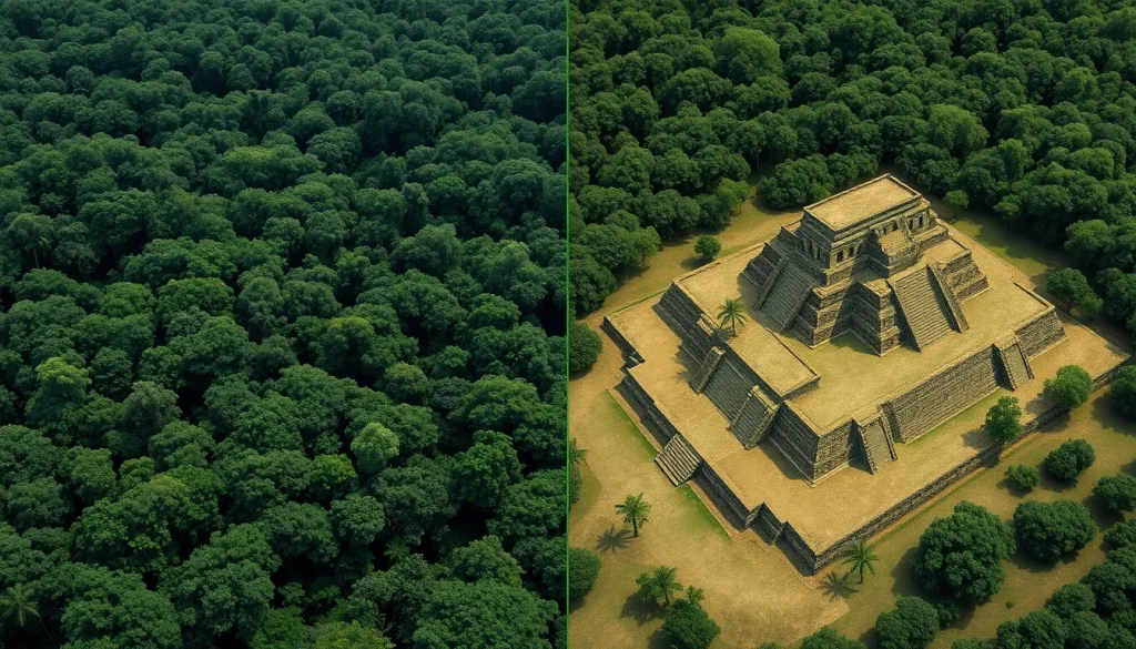
The dense tropical rainforests of Central America have long guarded the secrets of the Maya civilization, obscuring vast urban networks beneath layers of vegetation for centuries. Traditional archaeological methods, reliant on ground surveys and excavation, were slow and limited by the impenetrable jungle canopy. However, the advent of Light Detection and Ranging (LiDAR) technology has fundamentally transformed the field of Mesoamerican archaeology. By using laser pulses to map the ground surface digitally, researchers can now see through the forest to reveal ancient causeways, fortifications, and residential complexes that were previously invisible. This technological leap has not only identified thousands of new structures but has also forced a dramatic revision of demographic models regarding the Classic Maya period.
Main Explanation
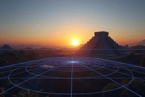
The application of LiDAR in Maya archaeology represents a paradigm shift comparable to the introduction of radiocarbon dating. Prior to these advancements, archaeologists understood Maya cities as isolated ceremonial centers surrounded by sparse settlements. The jungle was viewed as a barrier that protected ruins but also hid the true scale of urbanization. LiDAR operates by emitting laser pulses from an aircraft toward the ground. While some pulses are reflected by the tree canopy, others penetrate gaps in the foliage to reach the forest floor. By measuring the time it takes for each pulse to return, sensors create a precise three-dimensional map of the terrain.
Once the data is processed, algorithms can digitally strip away the vegetation, leaving behind a bare-earth model known as a Digital Elevation Model (DEM). This process reveals anthropogenic features such as house platforms, pyramids, and raised highways that blend seamlessly into the landscape when viewed from the ground. The significance of this technology lies in its ability to survey large areas rapidly. Where ground teams might take decades to map a single region, LiDAR can cover hundreds of square miles in days. This efficiency allows researchers to contextualize known sites like Tikal within a much broader urban landscape, revealing that what were once thought to be separate cities were actually part of interconnected megalopolises.
The implications for understanding Maya society are profound. The discovery of extensive defensive fortifications suggests a landscape of warfare far more intense than previously believed. Similarly, the identification of sophisticated water management systems and elevated highways indicates a level of centralized planning and engineering capability that challenges older narratives of Maya decline and disorganization. The technology does not replace excavation but rather guides it, allowing archaeologists to target specific features for ground-truthing rather than searching blindly through the undergrowth.
Evidence & Sources
The most significant evidence of LiDAR’s impact comes from the PACUNAM (Patrimonio Cultural y Natural Maya) project in northern Guatemala. In a groundbreaking survey published around 2018, researchers mapped over 810 square miles (2,100 square kilometers) in the Peten region. The data revealed more than 60,000 hidden Maya ruins, including houses, palaces, elevated highways, and defensive fortifications. This finding suggested that the Maya population was millions larger than previous estimates, indicating a density comparable to contemporary civilizations in Europe or Asia. Stephen Houston, Professor of Archaeology and Anthropology at Brown University, described the magnitude of the survey as “breathtaking,” noting it as one of the greatest advances in over 150 years of Maya archaeology.
Further evidence emerged in Mexico’s Yucatan Peninsula. In 2023, scientists utilized light-mapping technology to identify the lost city of Ocomtun in the state of Campeche. This discovery highlighted how common such findings were becoming, with researchers joking about throwing a map and hitting a lost city. The Ocomtun find included monumental architecture and artifacts such as relief carvings on stairway blocks, confirming the presence of a major urban center in an area previously thought to be less densely populated. These discoveries collectively demonstrate that the Maya lowlands were not a scattered collection of city-states but a densely populated, interconnected network of urban centers.
The physical evidence uncovered via LiDAR guidance includes raised causeways known as sacbeob, which connected cities and facilitated trade and military movement. Reservoirs and irrigation channels revealed by the laser scans indicate complex agricultural systems capable of supporting large populations despite the challenging tropical environment. Defensive structures, such as walls and moats around Tikal, suggest that these cities were heavily fortified, pointing to endemic warfare during the Late Classic period. These features, invisible from the ground due to vegetation, are now clearly defined in the digital models, providing a robust dataset for analyzing Maya political geography and urban planning.
Deep Dive Analysis
Module F: Digital Archaeology
Technology Description: LiDAR (Light Detection and Ranging) is a remote sensing method that uses light in the form of a pulsed laser to measure ranges (variable distances) to the Earth. In archaeology, it is specifically used to generate high-resolution topographic maps.
How It Works: A LiDAR instrument is mounted on an aircraft or drone. It emits rapid pulses of laser light at the surface, often exceeding 100,000 pulses per second. A sensor measures the time it takes for each pulse to return after hitting an object. Since the speed of light is constant, the distance to the object can be calculated with high precision. Multiple returns are recorded for each pulse, capturing the canopy, understory, and ground.
Field Workflow: The process begins with mission planning to ensure overlapping flight paths for complete coverage. Once the data is collected, it undergoes processing to classify points. Points hitting vegetation are filtered out, leaving only the ground returns. This creates a Digital Terrain Model (DTM). Archaeologists then analyze the DTM using visualization techniques like sky-view factor or local relief models to enhance subtle man-made features.
Output/Data: The primary output is a georeferenced point cloud and derived raster maps. These maps show elevation changes as small as 10 centimeters. Features such as house mounds, which may appear as natural hills to the naked eye, are revealed as rectangular platforms in the data. The data is often integrated into Geographic Information Systems (GIS) for spatial analysis.
Example: The PACUNAM survey in Guatemala is the premier example. It covered 2,100 square kilometers and identified 60,000 structures. Another example is the Ocomtun discovery in Campeche, Mexico, where LiDAR identified a large urban layout leading to ground confirmation of monumental structures.
Strengths: The primary strength is penetration; LiDAR sees through vegetation that obscures optical imagery. It is non-invasive, preserving the site until excavation is necessary. It is also scalable, allowing for regional analysis rather than site-specific tunnel vision. The speed of data acquisition is unmatched by ground surveys.
Limitations: LiDAR cannot determine the chronology of a structure; ground truthing is still required to date findings. It is expensive, requiring specialized aircraft and processing software. Dense vegetation can sometimes still obscure ground returns if the canopy is too thick. Additionally, it cannot detect artifacts buried beneath the soil surface, only surface topography.
Accuracy: Modern archaeological LiDAR achieves vertical accuracy within 10 to 20 centimeters. This is sufficient to distinguish between natural geology and human-made platforms. Horizontal accuracy is similarly high when combined with GPS ground control points.
Cultural Heritage Considerations: While LiDAR aids preservation by reducing the need for destructive surveying, the publication of precise location data poses a risk. Detailed maps can facilitate looting if accessed by illicit traffickers. Researchers must balance open science with the protection of vulnerable sites. Furthermore, the technology must be used in collaboration with local communities and descendant populations to ensure ethical stewardship of the revealed heritage.
FAQ
How does LiDAR see through the jungle?
LiDAR emits laser pulses that penetrate gaps in the vegetation canopy. Some pulses reach the ground and return, allowing sensors to map the surface beneath the trees.
Did LiDAR replace traditional excavation?
No, LiDAR guides excavation. It identifies targets for ground teams, but physical digging is still required to date artifacts and confirm structures.
Where were the major LiDAR discoveries made?
Major surveys were conducted in northern Guatemala (Peten region) and central Mexico (Campeche), revealing cities like Tikal and Ocomtun.

Leave a Reply