
Short Answer
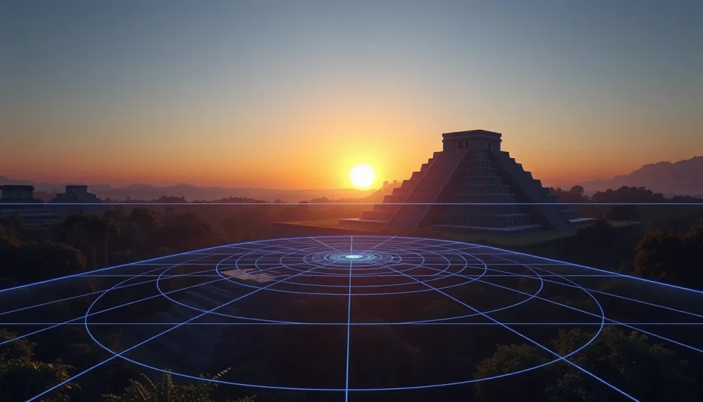
The intersection of archaeology and computational technology has fundamentally transformed the study of ancient Maya astronomy. For decades, scholars have debated whether specific architectural configurations were functional observatories or symbolic representations of cosmological principles. The advent of digital sky models, Geographic Information Systems (GIS), and Virtual Reality (VR) reconstructions has provided a rigorous framework for testing these hypotheses. By simulating the ancient sky over precise topographical landscapes, researchers can now verify architectural alignments with a degree of accuracy previously unattainable through field survey alone. This digital approach allows for the quantitative analysis of alignment data, moving the discipline from speculative interpretation to evidence-based verification.
Main Explanation
Digital sky modeling involves the creation of three-dimensional virtual environments that replicate the architectural and natural landscape of a Maya site as it existed during the Classic or Preclassic periods. These models integrate archaeological survey data, LiDAR topography, and astronomical algorithms to calculate the position of celestial bodies—such as the sun, moon, Venus, and stars—relative to specific architectural sightlines. The primary goal is to determine if the orientation of temples, plazas, and E-Group complexes corresponds to significant astronomical events, such as solstices, equinoxes, or zenith passages.
The methodology relies on the principle that the Maya intentionally oriented their ceremonial architecture to mark cycles of time essential to their ritual calendar and agricultural planning. Digital tools allow archaeologists to input the exact coordinates of a site, the elevation of the horizon, and the specific date range of construction. The software then renders the view from a designated observation point, showing exactly where the sun would rise or set on any given day in the past. This process helps distinguish between alignments that are statistically significant and those that may be coincidental. For instance, while early excavations in the 1920s at Uaxactún identified Group E complexes as observatories for equinoctial and solstitial sunrises, modern digital analysis tests whether these alignments hold true across a larger sample of sites in the central lowlands of the Yucatan peninsula.
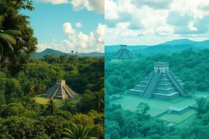
Furthermore, digital models account for changes in the landscape over time. Vegetation growth, erosion, and later construction phases can obscure original sightlines. By stripping away modern disturbances in a virtual environment, researchers can restore the “historical landscape” to evaluate the original visual experience of the Maya elites. This is crucial for understanding how astronomical knowledge was privileged and controlled, as seen in the development of observation systems that evolved from open landscape markers to restricted architectural forms.
Evidence & Sources
The application of digital sky models is supported by a growing body of archaeological and archaeoastronomical literature. Recent quantitative analyses of alignment data have challenged earlier assumptions about the uniformity of Maya astronomical architecture. For example, a study published in PLOS One examined Group E-type complexes, noting that while many were interpreted as observatories for sighting equinoctial and solstitial sunrises, hypotheses now range from paramount observational roles to merely allegorical allusions to celestial cycles. The study utilized quantitative analyses of a reasonably large sample of alignment data to assess these claims, highlighting the need for rigorous statistical verification rather than reliance on isolated case studies.
At the site of Cerros, Belize, researchers have employed Virtual Reality to understand astronomical knowledge and historical landscapes during the Preclassic period. Investigations argue that the ancient Maya of Cerros initially observed features in the coastal landscape that marked zenith events. Over time, they constructed buildings to memorialize these observation points on a unique promontory. As the site grew, the system of observation developed into a form of architecture that only elites could access, creating a separate privileged form of knowledge. Three-dimensional reconstructions based on recorded archaeological data focused on how the Maya at Cerros developed an astronomically influenced cosmological system, marking horizon events such as the spring equinox through architecture that moulded ceremonial activities.
Similarly, a reanalysis of the archaeoastronomy of Tikal published in Astronomische Nachrichten (2023) reassessed earlier fieldwork by Aveni and Hartung (1988). While the 1988 survey revealed relationships between astronomical and dynastic aspects of the great temples, recent breakthroughs in glyph decipherment and rigorous archaeoastronomy interpretations have updated our understanding. Surveys by Šprajc (2021) demonstrated the importance of the Maya ritual calendar in the placement and orientation of ceremonial public architecture. The aim of such reanalyses is to integrate dynastic history with astronomical data, ensuring that digital models reflect the specific historical context of the construction phases rather than a generalized “Maya” perspective.
Foundational work by Šprajc and Sánchez Nava (2016) in the Journal of Skyscape Archaeology further established the framework for analyzing astronomy and architecture in the Maya Lowlands. Their research underscores that architectural orientations are often tied to the 260-day ritual calendar and the solar year, providing the algorithmic basis for many contemporary digital sky models. These sources collectively validate the use of digital tools not as replacements for fieldwork, but as essential instruments for synthesizing complex spatial and temporal data.
Deep Dive Analysis
Module F: Digital Archaeology
Technology Description
Digital sky modeling in Maya archaeoastronomy utilizes specialized software such as SkyGlobe, Stellarium, and custom GIS plugins. These tools combine astronomical ephemerides with digital elevation models (DEMs) derived from LiDAR or total station surveys. The technology allows for the simulation of celestial mechanics over millennia, accounting for precession and proper motion of stars.
How It Works
The process begins with the georeferencing of architectural features. Archaeologists map the exact latitude, longitude, and elevation of observation points (e.g., the top of a western pyramid in an E-Group) and target points (e.g., the eastern horizon temple). This data is imported into the digital environment. The software calculates the azimuth and altitude of celestial bodies for specific historical dates. By overlaying the digital skyline with the modeled architecture, researchers can visualize the alignment.
Field Workflow
1. Survey: Precision mapping of site architecture using Total Stations or GNSS receivers.
2. Landscape Modeling: Integration of LiDAR data to reconstruct the ancient horizon, removing modern vegetation.
3. Astronomical Calibration: Setting the software to the specific epoch of construction (e.g., 200 BCE for Preclassic Cerros).
4. Simulation: Running simulations for key dates (solstices, equinoxes, Venus extremes).
5. Verification: Comparing simulation results with architectural axes.
Output/Data
The primary output is a set of azimuthal measurements correlated with celestial events. Visual outputs include rendered videos of sunrises from the perspective of an ancient observer. Quantitative data includes statistical probabilities of alignments occurring by chance versus design. For example, VR reconstructions at Cerros produced 3D visualizations showing how the architecture framed the zenith sun.
Example
At Tikal’s Mundo Perdido complex, digital models were used to reassess the orientation of the Lost World Pyramid. While early theories suggested broad solar alignments, recent digital reanalysis incorporating Šprajc’s 2021 data indicates a tighter correlation with specific ritual calendar dates rather than just generic solar quarters. This nuance was only visible through precise digital modeling of the horizon profile.
Strengths
Digital models allow for non-invasive testing of hypotheses. They can simulate thousands of years of sky data in minutes. They also enable the visualization of “lost” landscapes, such as the coastal horizon at Cerros before sea-level changes or deforestation. This helps in understanding the phenomenological experience of the ancient Maya.
Limitations
Models are only as accurate as the input data. If the archaeological dating of a structure is incorrect, the astronomical simulation will be anachronistic. Furthermore, digital models cannot account for atmospheric conditions like haze or cloud cover that would have affected actual visibility. There is also the risk of “data dredging,” where researchers test so many dates that a significant alignment is found by chance.
Accuracy
When based on high-resolution LiDAR and precise survey data, digital sky models can achieve accuracy within 0.1 degrees of azimuth. This is sufficient to distinguish between solstitial and equinoctial alignments. However, accuracy decreases for stellar alignments due to the proper motion of stars over long periods, requiring careful calibration of astronomical algorithms.
Cultural Heritage Considerations
The use of digital models must respect the cultural significance of the sites. While VR can democratize access to heritage, it should not replace the physical preservation of the sites. Additionally, interpretations of astronomical function should be presented as hypotheses supported by evidence, rather than absolute facts, to avoid misrepresenting Maya intellectual history as merely functionalistic.
FAQ
Did the Maya use E-Groups as actual observatories?
Debate continues. While early theories suggested they were functional observatories for solstices and equinoxes, recent quantitative analyses suggest some may have been allegorical or commemorative without direct observational use.
How does Virtual Reality help in Maya archaeology?
VR allows researchers to reconstruct historical landscapes and sightlines that no longer exist due to vegetation or ruin, enabling precise testing of astronomical alignments from the perspective of ancient observers.
What is the significance of the Mundo Perdido at Tikal?
It is one of the oldest pre-Classic E-Groups in the Petén. Recent reanalyses use digital models to understand how its orientation relates to the Maya ritual calendar and dynastic history.
Can digital models prove astronomical intent?
Digital models provide statistical probability. They can show if an alignment is too precise to be coincidental, but archaeological context is required to confirm intent.

Leave a Reply