
Short Answer
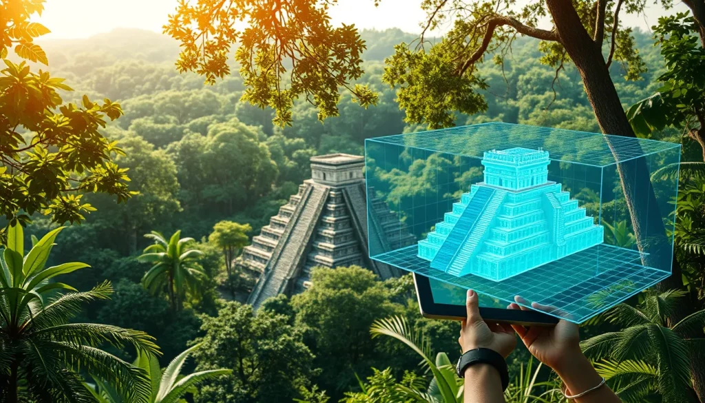
The digital reconstruction of ancient Maya cityscapes represents a critical intersection between archaeological inquiry and modern technological capability. Traditionally, creating three-dimensional models of archaeological sites was an expensive, time-consuming endeavor requiring significant specialized expertise. However, the advent of advanced digital heritage technologies has streamlined the integration of multiple data types, allowing scholars to produce digital reconstructions in a time-efficient and cost-effective manner. These models are no longer static representations but dynamic tools used to test and formulate alternative hypotheses derived from underlying archaeological data. As collaborative and large-scale mapping projects grow more common across the Maya region, the establishment of best practices ensures that these digital assets remain reproducible, comparable, and scientifically rigorous.
Main Explanation
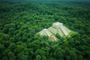
Best practices for 3D reconstruction of Maya sites encompass a range of methodologies designed to capture, process, and visualize spatial data with high fidelity. The core objective is to create multi-resolution models that fulfill both measurement and archaeological needs while serving public education purposes. This involves the seamless combination of data from Unmanned Aerial Vehicles (UAV), terrestrial images, and terrestrial Time-of-Flight (TOF) laser scanners. A significant advancement in this field is the shift towards procedural modeling, which allows for the rapid prototyping of 3D models from a set of rules. Unlike manual modeling, procedural approaches enable scholars to quickly update reconstructions to reflect new findings or test alternative architectural hypotheses without rebuilding the entire cityscape from scratch.
Furthermore, the workflow has evolved towards interoperable cloud-based visualization systems. These systems allow for the creation of archaeological atlases, such as the Palenque 3D Archaeological Atlas, which integrate 3D surveying data with cultural heritage protection protocols. The emphasis is on developing workflows that are not only technically robust but also accessible to interdisciplinary teams. This includes archaeologists, computer scientists, and heritage managers who need to interact with the data differently. By standardizing the visualization of elevation data, researchers can reduce the reliance on ad hoc or aesthetically motivated methods that previously reduced the comparability of results across different sites and studies.
Evidence & Sources
The methodological framework for 3D reconstruction in the Maya region is supported by several key case studies and technical publications. Research conducted at the UNESCO World Heritage Site of Copan, Honduras, has been instrumental in identifying initial methodological challenges and solutions for procedural modeling of ancient Maya cityscapes. Studies from 2015 highlighted that while procedural modeling was being used for Roman and Greek cities, its application in the Maya region was initially limited to individual buildings. The Copan case study demonstrated the viability of expanding this approach to entire cityscapes, facilitating the integration of archaeological data into digital hypotheses.

Subsequent work has focused on multi-sensor documentation. Projects involving Copan have utilized UAV and terrestrial images together with terrestrial TOF laser scanner data to produce multi-resolution models. These preliminary 3D results reported in earlier documentation efforts laid the groundwork for more complex integrations. More recently, the development of the Palenque 3D Archaeological Atlas in 2023 exemplifies the move towards interoperable cloud-based visualization workflows. This project underscores the importance of 3D surveying and cultural heritage protection, linking technical data acquisition with broader research and protection goals.
Standardization remains a critical area of evidence-based development. A comprehensive review published in 2025 regarding Ancient Maya LiDAR research emphasized that despite the unprecedented visibility offered by Airborne Laser Scanning (ALS), visualization of elevation data remained unstandardized. The review evaluated various techniques for effectiveness and reproducibility across varying terrain types. It highlighted the combined Visualization for Archaeological Topography (combined VAT) as a particularly robust base visualization. This evidence supports the best practice of adopting standardized visualization techniques to ensure that collaborative mapping projects yield consistent and scientifically valid results.
Deep Dive Analysis
Technology Description
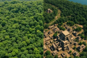
The primary technologies employed in best practice 3D reconstruction include Airborne Laser Scanning (ALS), commonly known as LiDAR, and terrestrial photogrammetry. LiDAR offers unprecedented visibility of anthropogenic terrain modifications in densely forested environments, penetrating vegetation to reveal ground surfaces. Terrestrial technologies include Time-of-Flight (TOF) laser scanners and UAV-based imaging, which capture high-resolution texture and geometry of standing structures.
How It Works
LiDAR systems emit laser pulses from an aircraft and measure the time it takes for the light to return, creating a point cloud of the landscape. Terrestrial scanners operate similarly but from the ground, capturing intricate architectural details. Photogrammetry uses overlapping photographs to calculate spatial measurements. In best practice workflows, these data sources are not used in isolation. They are processed and seamlessly combined to produce a multi-resolution model. Procedural modeling software then applies rule-based algorithms to generate architectural features based on archaeological parameters.
Field Workflow
The workflow begins with sensor and data acquisition, involving the coordination of airborne and ground-based teams. Data processing follows, where point clouds are cleaned, classified, and merged. This stage requires significant expertise to ensure that noise is removed without losing archaeological features. The processed data is then integrated into a cloud-based visualization workflow, allowing for interoperable access. This ensures that researchers can collaborate remotely and that the data is preserved in a format that supports long-term access and updates.
Output and Data
The final output includes digital 3D models suitable for research and public education. These models serve as digital twins of the archaeological sites. In the case of the Palenque 3D Archaeological Atlas, the output is an interoperable system that supports archaeological research and protection. For Copan, the output includes multi-resolution models that fulfill measurement needs. The data is often structured to allow for hypothesis testing, where scholars can manipulate variables to see how different reconstruction scenarios fit the underlying evidence.
Example
The Copan Archaeological Project serves as a primary example. Here, procedural modeling was applied to reconstruct ancient cityscapes rather than just individual buildings. Similarly, the Palenque project demonstrates the use of cloud-based workflows to manage complex 3D data. These examples illustrate the transition from static modeling to dynamic, data-rich environments that support ongoing research.
Strengths
The primary strength of these best practices is the ability to streamline integration of multiple data types in a time-efficient manner. Procedural modeling allows for quick updates and hypothesis testing. LiDAR provides visibility in densely forested environments where traditional surveying is impossible. Standardized visualization ensures reproducibility and comparability of results across different research teams and regions.
Limitations
Despite advancements, challenges remain. Digital reconstruction is still resource-intensive regarding computational power and expertise. Visualization of elevation data can still suffer from unstandardized methods if researchers rely on aesthetically motivated techniques. There is also the challenge of maintaining interoperability between different software platforms and ensuring long-term data preservation in cloud environments.
Accuracy
Accuracy is maintained through multi-sensor approaches. By combining UAV images with terrestrial laser scanner data, researchers can cross-verify measurements. The use of standardized visualization techniques like combined VAT further enhances the reliability of terrain analysis. However, accuracy is dependent on the quality of the underlying archaeological data; digital models are only as valid as the hypotheses and evidence they are built upon.
Cultural Heritage Considerations
Best practices emphasize that these technologies serve both research and public education purposes. Digital models provide access to sites that may be physically inaccessible or fragile. However, there is an ethical consideration regarding the representation of indigenous heritage. Workflows must respect the cultural significance of the sites and involve relevant stakeholders. The focus on protection, as seen in the Palenque Atlas, ensures that digital reconstruction supports the physical preservation of the heritage site rather than merely exploiting it for visualization.
FAQ
Why is LiDAR preferred for Maya site reconstruction?
LiDAR offers unprecedented visibility of anthropogenic terrain modifications in densely forested environments where traditional surveying is obstructed by vegetation.
What is procedural modeling in archaeology?
Procedural modeling is the rapid prototyping of 3D models from a set of rules, allowing scholars to quickly update reconstructions and test alternative hypotheses.
How do researchers ensure visualization reproducibility?
Researchers use standardized methods like the combined Visualization for Archaeological Topography (VAT) to reduce ad hoc visualization and ensure comparability.
Leave a Reply