
Short Answer
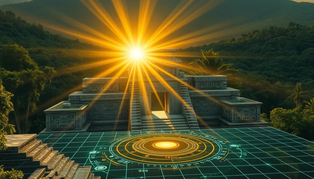
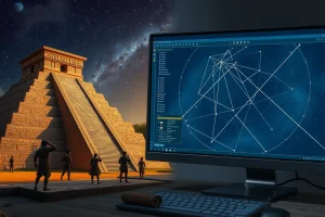
The application of 3D simulation technology in Mesoamerican archaeology represents a paradigm shift in how researchers investigate the sophisticated astronomical knowledge of the ancient Maya civilization. By creating precise digital replicas of archaeological sites, scholars can test hypotheses regarding architectural alignments with celestial bodies such as the sun, moon, and Venus without risking damage to fragile ruins. This methodology bridges the gap between theoretical cosmology and physical architecture, allowing for the dynamic visualization of light and shadow patterns that would have been significant to Maya priests and architects. The integration of survey data, photogrammetry, and dynamic modeling capabilities enables a level of precision that traditional ground-based surveys cannot achieve alone.
Main Explanation
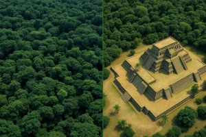
3D simulation used to test Maya architectural alignments involves the creation of virtual environments that replicate the exact geographical and structural conditions of ancient sites. Researchers begin by gathering high-resolution spatial data through LiDAR, total station surveys, or photogrammetry. This data is imported into 3D modeling software where structures are reconstructed to their probable original heights and orientations. Once the digital model is established, simulation tools are employed to replicate the movement of celestial bodies over specific historical dates. This process allows archaeologists to observe how sunlight interacted with doorways, windows, and stelae during solstices, equinoxes, or planetary extremes. The ability to manipulate time and viewpoint within the simulation provides critical evidence for understanding the intentional design of spaces dedicated to astronomical observation.
The software environment used for these simulations often includes advanced dynamic modeling capabilities. While various tools exist, the principles of using 3D modeling environments to explore non-standard spaces and environmental conditions are well-documented in architectural design research. For instance, interdisciplinary design approaches utilize simulation to explore how environmental conditions, such as wind or light, act as catalysts for form generation. In the context of archaeology, this is reversed; the form is known, and the simulation tests the environmental conditions that influenced it. By setting virtual cameras and lighting rigs that match astronomical ephemerides, researchers can validate whether a structure’s orientation was accidental or deliberately calculated to frame specific celestial events. This digital methodology supports the acknowledgment of local climatic and astronomical situations that shaped hyper-localized architecture.
Evidence & Sources
Archaeological evidence for these alignments is increasingly supported by digital collections and web-based 3D Geographic Information Systems (GIS). The MayaArch3D Project, for example, has built a virtual research environment specifically for the documentation and analysis of complex archaeological sites like the UNESCO World Heritage site of Copan in Honduras. This interdisciplinary project integrates 3D models of cities, landscapes, and objects with associated geo-referenced archaeological data. By bringing together archaeologists, art historians, and experts in geosciences and 3D modeling, the project demonstrates how digital collections can contain basic information for ancient Maya cities while focusing on specific archaeology such as that found in Copan. The digital archives allow for the integration of objects and archives dispersed in collections around the world into a single spatial context.

Furthermore, the technical process of evaluating solutions with imported geometry is critical for accuracy. In 3D modeling workflows, the best evaluation of a solution is to set an object in front of a solved camera to see if it matches the background as the animation plays. This technique, often used in survey data solving, ensures that the digital reconstruction aligns perfectly with the physical reality captured in photographs or scans. Constraints such as point constraints are used to orient the solution so that specific features, like a fence corner or architectural edge, match the origin of the model exactly. This precision is vital when testing alignments, as even minor discrepancies in orientation can lead to incorrect conclusions about astronomical intent. The use of registered solutions and survey constraints ensures that the virtual simulation remains grounded in empirical data.
Deep Dive Analysis
Technology Description
The core technology involves 3D visualization and analysis systems tailored for archaeological research. These systems function as web-based 3D-GIS platforms that can integrate diverse data types. The software environment allows for the creation of alternative spaces away from traditional Euclidean geometry, which is essential for modeling the complex, non-standard spaces often found in Maya architecture. Students and researchers learn to use animation and simulation as part of the design and analysis process, not just as a presentation tool. This opens up new horizons for understanding non-standard spaces and their relationship to the environment.
How It Works
The workflow begins with data acquisition, followed by modeling and then simulation. Dynamic modeling capabilities allow for the exploration of new typologies that open up discussion towards the acknowledgment of local climatic situations. In archaeology, this means simulating the sun’s path relative to the structure. The stimulation of this discussion generates awareness of environmental conditions and leads towards recognition for resilience and subjectivity in design. By using environmental conditions with the strongest effect, such as sunlight, as a catalyst, researchers take the vagaries of concepts and plant them into responsive forms that excel in exploring the possibilities of architecture based on its immediate environment.
Field Workflow
Fieldwork involves collecting survey data that will later be imported into the modeling environment. Researchers must add constraints to orient the solution correctly. For example, a point constraint might be added to orient the solution so a specific corner is at the origin. This is necessary because the modeled object must have its corner at the origin to match the survey data exactly. To reorient the solution, specific track points are selected within the software’s outliner. Once the survey data is registered, the modeled geometry is imported to match the filmed or scanned reality. This ensures that the virtual camera matches the physical camera position used during data capture.
Output/Data
The output consists of geo-referenced archaeological data integrated with 3D models of cities, landscapes, and objects. These digital collections provide basic information for ancient Maya cities in Central America. The data allows for the documentation and analysis of complex archaeological sites in a virtual research environment. The resulting models can be used to generate building forms with the capacity to emanate communicative energy of the city, or in the archaeological context, to demonstrate how the city communicated with the cosmos. The data supports the exploration of design narratives that best respond to environmental circumstances.
Example
A primary case study is the ancient Maya city of Copan, Honduras. Institutions from many countries have excavated at Copan since the mid-nineteenth century, and objects from Copan and related archives are dispersed in collections around the world. The MayaArch3D project uses this site to demonstrate the system. By focusing on the archaeology of Honduras and specifically Copan, the project integrates dispersed objects into a cohesive 3D web GIS. This allows researchers to analyze the site’s layout in relation to astronomical phenomena without needing physical access to every artifact or structure simultaneously.
Strengths
The primary strength is the ability to conduct non-invasive analysis. Researchers can test multiple hypotheses about alignments without disturbing the site. Additionally, 3D modeling environments allow for the creation of spaces away from Euclidean geometry, which is beneficial for modeling organic or complex ancient structures. The use of animation and simulation as part of design helps architectural students and archaeologists learn to use these tools not just for presentation, but for discovery. This provides new horizons for non-standard spaces and allows for the exploration of possibilities based on the immediate environment.
Limitations
Limitations include the accuracy of the initial survey data. If the imported geometry does not match the background exactly, the simulation results may be flawed. The evaluation of the solution requires setting an object in front of the solved camera to verify matches. Furthermore, digital models are interpretations; they rely on assumptions about original heights and roof structures that may not be fully preserved. The process of using environmental conditions as a catalyst takes concepts and plants them into forms, but these forms are still digital approximations of historical reality. There is always a risk of over-interpreting alignments that may be coincidental.
Accuracy
Accuracy is maintained through rigorous constraint management. Adding survey constraints, such as point constraints, ensures that the solution is oriented correctly. The solver creates a registered solution that matches the modeled fence or structure to the survey data. The best evaluation is visual verification where the modeled object matches the background as the animation plays. This level of precision is required to claim that a specific architectural feature aligns with a specific celestial event within a margin of error acceptable for archaeological publication.
Cultural Heritage Considerations
Digital heritage projects must respect the cultural significance of the sites. The MayaArch3D project is an international, interdisciplinary effort that brings together archaeologists, art historians, and cultural resource managers. This collaboration ensures that the digital representation respects the cultural context. By integrating geo-referenced archaeological data, the project supports the documentation and analysis of complex sites while acknowledging the dispersed nature of cultural objects. The goal is to generate awareness of environmental conditions and lead towards recognition for resilience, ensuring that the digital twin serves the preservation and understanding of the physical heritage.
FAQ
What software is used to simulate Maya architectural alignments?
Researchers use a variety of 3D modeling and GIS tools. Projects like MayaArch3D utilize web-based 3D-GIS systems, while other studies may employ dynamic modeling software capable of handling survey data and imported geometry to ensure precise alignment testing.
How accurate are 3D simulations compared to physical surveys?
Accuracy depends on the quality of the input survey data. By using point constraints and registering solutions so that modeled corners match the origin exactly, researchers can achieve high precision. The best evaluation involves visually verifying that imported objects match the background survey data during animation.
Why is Copan used as a case study for 3D archaeological visualization?
Copan is a UNESCO World Heritage site with extensive excavation history since the mid-nineteenth century. Objects and archives from Copan are dispersed globally, making a digital 3D integration project ideal for reunifying data and analyzing the site’s complex archaeology in a virtual environment.
Leave a Reply