
Short Answer
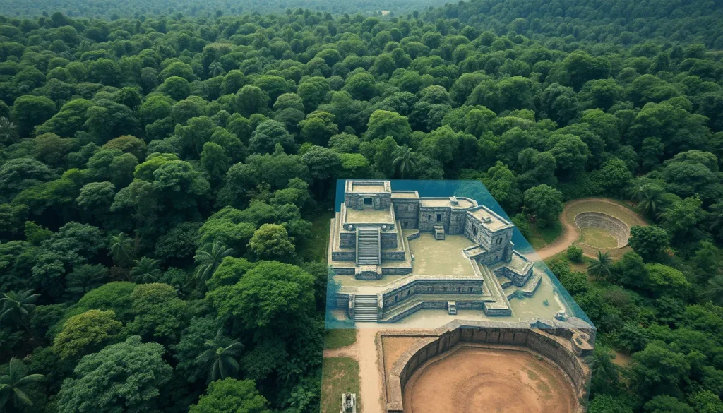
The application of Light Detection and Ranging (LiDAR) technology to the dense tropical forests of northern Guatemala has fundamentally altered archaeological understanding of the ancient Maya civilization. Prior to the widespread adoption of airborne laser scanning, estimates of Maya population density were constrained by the limitations of ground-based surveys and the obscuring vegetation of the Petén region. In a groundbreaking study published in 2018, researchers utilized LiDAR to digitally remove the forest canopy, revealing a sprawling network of cities, houses, and agricultural systems that suggests the Maya lowlands supported a population far larger than previously imagined. This technological breakthrough indicated that the region was not merely a collection of isolated city-states but rather a highly interconnected megalopolis during the Classic period.
The implications of these findings extend beyond mere population counts. The discovery of extensive defensive structures, elevated highways, and modified agricultural terrain points to a society characterized by complex political systems, large-scale conflict, and centralized planning. The data suggests that during the Classic Maya heyday, roughly between 250 and 900 CE, the landscape was heavily engineered to support millions of people. This shift in perspective requires a reevaluation of Maya socio-political organization, agricultural capacity, and the environmental impact of their civilization on the lowland tropics.
Main Explanation
The core revelation provided by LiDAR mapping in northern Guatemala is the sheer scale of human modification to the landscape. Before this technology, archaeologists relied on visible ruins poking through the jungle, which often led to underestimations of urban sprawl. The LiDAR data revealed more than 60,000 previously unknown human-made features, including houses, palaces, and elevated highways. This density implies that the Maya population in this region was in the millions, significantly higher than prior models suggested. The civilization was not sparse; it was intensive.
Furthermore, the spatial distribution of these features indicates a high degree of connectivity. The mapping identified approximately 106 kilometers of causeways within and between sites. These roads served as evidence of inter- and intracommunity connectivity, facilitating trade, military movement, and political integration across vast distances. The presence of such infrastructure supports the theory of interconnected cities functioning within broader political systems, starting at least several hundred years before the rise of Classic Maya society. This challenges the older notion of isolated ceremonial centers surrounded by sparse populations.
Agricultural intensity was another critical factor revealed by the laser mapping. Analysis identified 362 square kilometers of deliberately modified agricultural terrain, including field systems in low-lying wetlands and terraces in upland areas. The scale of these wetland systems and their association with dense populations suggest centralized planning, whereas upland terraces cluster around residences, implying local management. Additionally, another 952 square kilometers of unmodified uplands were identified for potential swidden use. This combination of intensive and extensive agriculture demonstrates how the Maya sustained such high population densities in a tropical environment often considered unsuitable for large-scale farming.
Evidence & Sources
The primary evidence for these claims comes from an international team of scientists who reported their findings in the journal Science in September 2018. The research was part of the PACUNAM LiDAR Initiative, which conducted aerial laser scans of northern Guatemala. According to reports from ScienceNews and National Geographic, the laser-shooting eye in the sky revealed previously unappreciated size and complexity of the ancient Maya civilization, both before and during its presumed heyday. The data covered a vast area, allowing researchers to analyze patterns that were invisible from the ground.
Specific archaeological evidence includes the identification of sizable defensive features, which point to societal disconnection and large-scale conflict. This contrasts with the connectivity suggested by the causeways, indicating a complex political landscape where alliance and warfare coexisted. The ruins at the Classic Maya city of Tikal, for example, were shown to be part of this larger network, poking out of dense forests that previously hid the unexpected size of the civilization. The NSF Public Access Repository notes that the Lowland Maya civilization flourished in the tropical region of the Yucatan peninsula and environs for more than 2500 years, from approximately 1000 BCE to 1500 CE, providing a long timeline for this accumulation of infrastructure.
The credibility of these findings is bolstered by the involvement of prominent archaeologists and institutions. Authors of the study include Marcello A. Canuto, Stephen D. Houston, and Francisco Estrada-Belli, among others. Their analysis utilized airborne laser scanning to penetrate the canopy, providing a digital elevation model that stripped away vegetation to expose the ground surface. This method allowed for the identification of 60,000 houses and other features that had been hidden for centuries. The convergence of data from multiple sources, including National Geographic exclusives and peer-reviewed publications in Science, establishes a robust evidentiary basis for the revised population estimates.
Deep Dive Analysis
Module F: Digital Archaeology
Technology Description
LiDAR, short for Light Detection and Ranging, is a remote sensing method that uses light in the form of a pulsed laser to measure ranges (variable distances) to the Earth. In the context of Maya archaeology, this technology is mounted on aircraft to scan the ground below dense forest canopies. The system emits rapid pulses of laser light that travel to the ground and reflect back to the sensor. By measuring the time it takes for each pulse to return, the system calculates the distance to the object hit by the laser.
How It Works
The process involves emitting hundreds of thousands of laser pulses per second. Some pulses hit the top of the tree canopy, while others penetrate through gaps in the foliage to hit the ground. By collecting millions of these data points, known as a point cloud, researchers can create a highly detailed three-dimensional representation of the surface. Advanced algorithms are then used to classify the points, distinguishing between vegetation, buildings, and the bare earth. This allows archaeologists to digitally remove the forest canopy, revealing the topography and structures hidden beneath.
Field Workflow
The workflow begins with flight planning over the target area, in this case, northern Guatemala. Aircraft equipped with LiDAR sensors fly over the jungle in a grid pattern to ensure complete coverage. Once the data is collected, it is processed to generate digital elevation models (DEMs) and digital surface models (DSMs). Archaeologists then analyze these models to identify anomalies that correspond to human-made features such as walls, roads, and platforms. This process is significantly faster and more comprehensive than traditional ground surveys.
Output and Data
The output of a LiDAR survey includes high-resolution maps that show the ground surface as if the vegetation were not there. In the Maya project, this output revealed 362 square kilometers of modified agricultural terrain and 106 kilometers of causeways. The data allows for precise measurements of structure heights, volumes, and spatial relationships. This quantitative data is essential for calculating population density and understanding urban planning.
Strengths
The primary strength of LiDAR is its ability to see through dense vegetation, which is particularly valuable in tropical regions like the Petén. It covers large areas quickly, reducing the time and cost associated with ground reconnaissance. It also provides an objective record of the landscape that can be re-analyzed as new questions arise. The technology revealed that Maya cities were much larger than ground-based research had suggested, fundamentally changing historical narratives.
Limitations
Despite its power, LiDAR has limitations. It cannot date structures; it only reveals their presence. Archaeological interpretation and ground-truthing are still required to confirm the function and chronology of identified features. The technology is also expensive, requiring specialized aircraft and processing software. Additionally, very dense vegetation can sometimes obscure smaller features, though this is less of an issue than with satellite imagery.
Accuracy
LiDAR provides high vertical accuracy, often within centimeters, allowing for the detection of subtle earthworks and terraces. This precision was crucial in identifying the agricultural terraces and defensive structures mentioned in the 2018 studies. The accuracy of the spatial data enables researchers to map connectivity between sites with confidence, supporting theories of interconnected political systems.
Cultural Heritage Considerations
The use of LiDAR raises important cultural heritage considerations. While it helps protect sites by identifying them without destructive excavation, the data must be managed carefully to prevent looting. The revelation of such vast numbers of sites requires increased protection efforts by local governments. Furthermore, the interpretation of this data should involve collaboration with descendant communities to ensure respectful representation of their ancestors’ achievements.
FAQ
How did LiDAR change population estimates for the Maya?
LiDAR revealed over 60,000 previously hidden structures, suggesting the population was in the millions, far higher than ground-based surveys indicated.
What area of Guatemala was scanned?
The laser mapping focused on the northern Guatemala lowlands, including areas around the Classic Maya city of Tikal.
When was this major discovery published?
The findings were reported by an international team in the journal Science on September 28, 2018.
Did LiDAR find evidence of conflict?
Yes, sizable defensive features were identified, pointing to societal disconnection and large-scale conflict alongside connectivity.



Leave a Reply