
Short Answer
The advent of digital technologies has sparked lively discussions among bioarchaeologists and heritage specialists regarding how to ethically curate virtual replicas of funerary elements and ancient settlements. While these discussions have largely remained theoretical in the past, recent practical applications are beginning to bridge the gap between technological capability and ethical responsibility. The question of who owns digital Maya heritage is not merely a legal inquiry but a profound ethical challenge involving Indigenous communities, academic institutions, and the global public. As 3D models and LiDAR data become standard tools for preserving and perpetuating Indigenous heritage, the need for informed approaches to data management and sharing has never been more pressing.
Main Explanation
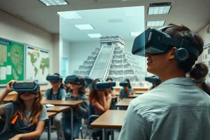
The core of the debate surrounding digital Maya heritage lies in the tension between open scientific dissemination and the ethical treatment of sensitive cultural materials. Digital collections, such as the web-based repository for 3D bioarchaeological data from the ancient Maya site of Palenque, aim to foster scientific collaboration while addressing pressing ethical concerns about the treatment of digital replicas of burials and human remains. These initiatives recognize that digital surrogates carry cultural weight similar to physical artifacts. Consequently, the storage, visualization, and dissemination of such data require protocols that respect descendant communities and avoid perpetuating historical inequities.
Furthermore, the introduction of broad-scale LiDAR to Maya archaeology over the last decade has resulted in a paradigm shift in the field, leading researchers to examine models of ancient complexity reflected in broadly sampled landscapes. However, this technological revolution has also raised a host of ethical issues that must be resolved, including concerns about new colonialism and data sovereignty. The reutilization and accessibility of open archaeological LiDAR data in the Americas remains elusive, highlighting an expectation that digital data should be shared contrasted with the reality of restricted access and ownership disputes. Ethical considerations now mandate collaborating with Indigenous communities on 3D heritage projects to ensure that the benefits of preservation are shared equitably.
Evidence & Sources
Recent scholarly work provides concrete evidence of the evolving ethical landscape in digital archaeology. In August 2026, researchers presented an ethically informed approach to the construction of och bih – Entró al camino, a digital collection hosted on the publicly accessible digital repository of the University Library of the Ludwig-Maximilians-Universität München. This collection specifically addresses the ethical curation of virtual replicas of funerary elements from Palenque, Mexico, demonstrating a practical application of ethical theory in digital heritage management.
Additionally, publications in American Antiquity as recently as April 2025 have highlighted the necessity of collaborating with Indigenous communities on 3D heritage projects. These sources emphasize that the use of 3D and relational technologies must be grounded in historical context and respect for Indigenous heritage. In terms of remote sensing, studies on LiDAR data management in Honduras illustrate the complexities of resurrecting and repurposing data for archaeology research. While the importance of reusing open data has been broadly recognized, the specific challenges regarding archaeological ALS data in the Americas persist. Meanwhile, analyses of a decade of LiDAR in Maya archaeology note that while the technology has transformed understandings of ancient occupation and land use, it necessitates resolving ethical issues related to data ownership and interpretation.
Deep Dive Analysis
Module F: Digital Archaeology
Technology Description
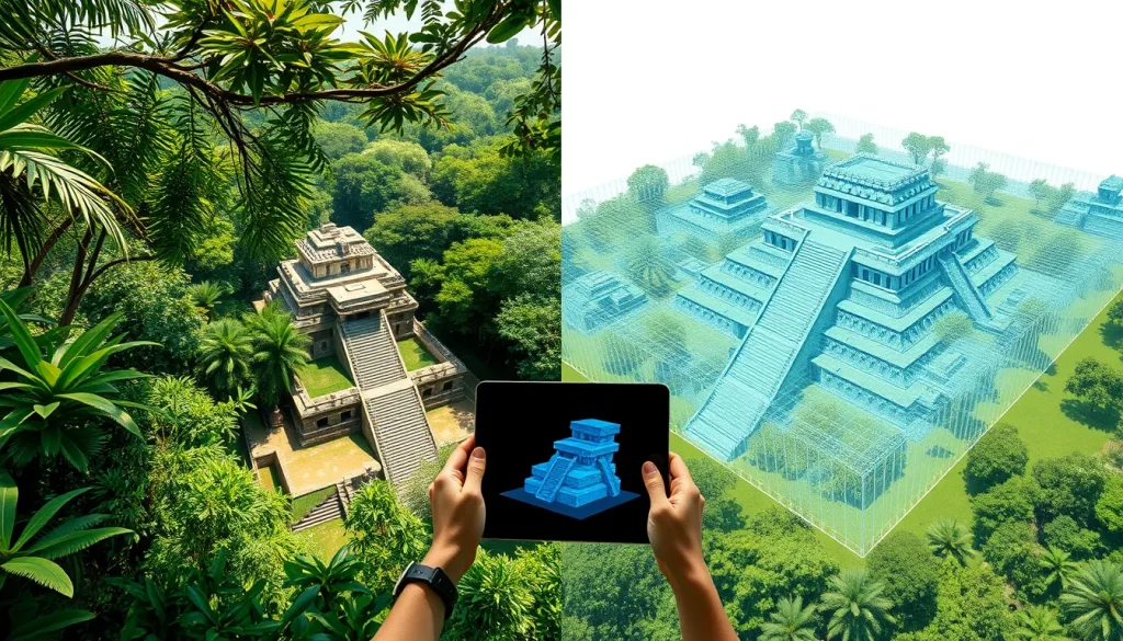
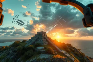
The primary technologies involved in digital Maya heritage include airborne laser scanning (ALS), commonly known as LiDAR, and terrestrial 3D modeling techniques such as photogrammetry. LiDAR involves the application of airborne mapping for archaeological prospection, capable of penetrating densely vegetated tropical regions to reveal underlying structures. Terrestrial 3D modeling focuses on creating high-fidelity virtual replicas of specific artifacts, funerary elements, or architectural features.
How It Works
Airborne LiDAR functions by emitting laser pulses from an aircraft to measure distances to the earth’s surface, generating precise digital elevation models. Terrestrial 3D modeling typically involves capturing hundreds of overlapping photographs of an object or site, which software then processes into a textured mesh. These processes allow for the storage and visualization of bioarchaeological data without requiring physical handling of fragile remains.
Field Workflow
The workflow begins with data collection, either through dedicated ALS collections or by repurposing data collected for other purposes, such as government entity open data. Following collection, the data undergoes processing to remove vegetation noise and classify archaeological features. For 3D models, the workflow includes ethical review before digitization, ensuring that sensitive funerary elements are treated with appropriate care before being added to a web-based collection.
Output/Data
The output consists of point clouds, digital elevation models, and textured 3D meshes. These datasets are stored in digital repositories, such as the University Library of the Ludwig-Maximilians-Universität München, designed for the storage, visualization, and dissemination of 3D bioarchaeological data. The data aims to foster scientific dissemination and collaboration while maintaining ethical standards.
Example
A prominent example is the och bih – Entró al camino collection, which hosts 3D models of Palenque’s ancient Maya funerary elements. Another example includes the use of LiDAR in Belize and Honduras to identify extensive settlement boundaries and public architecture that were previously obscured by jungle canopy.
Strengths
LiDAR has permitted a much broader view of sites, landscapes, and land use by revealing new public architecture and extensive settlement patterns. It offers clues to settlement boundaries and demonstrates the extent of ancient occupation and terraforming. Digital collections allow for the ethical dissemination of sensitive data without physical disturbance, bridging the gap between theoretical ethical discussions and practical applications.
Limitations
Despite the revolutionary effect on archaeology, the reutilization and accessibility of open archaeological ALS data in the Americas remains elusive. There are significant challenges in managing data that was collected for other purposes. Furthermore, digital replicas cannot fully replace the contextual understanding gained from physical excavation, and there is a risk of data misinterpretation without proper archaeological oversight.
Accuracy
LiDAR constitutes a major advance in Mesoamerican settlement studies by demonstrating the extent of ancient occupation with high precision. However, accuracy depends on the quality of the initial collection and the processing algorithms used to filter vegetation. Terrestrial 3D models provide high visual fidelity but require careful calibration to ensure metric accuracy for scientific analysis.
Cultural Heritage Considerations
The introduction of lidar to the research repertoire has raised a host of ethical issues that must be resolved, including concerns about new colonialism. Ethical frameworks now prioritize collaborating with Indigenous communities on 3D heritage projects to preserve and perpetuate Indigenous heritage respectfully. There is a growing consensus that digital replicas of burials and human remains require specific ethical curation to avoid commodification. Data management strategies must balance the expectation that digital data should be open with the rights of descendant communities to control their heritage.
FAQ
Why is ethical curation important for 3D models of Maya burials?
Ethical curation is vital because digital replicas of burials and human remains carry cultural significance. Proper management ensures respect for descendant communities and avoids the commodification of sensitive heritage.
What is the main challenge with LiDAR data in the Americas?
The main challenge is the reutilization and accessibility of open archaeological ALS data. While open data is expected, accessibility remains elusive compared to geosciences data.
How does LiDAR change Maya archaeology?
LiDAR has had a revolutionary effect by revealing extensive settlement patterns, public architecture, and land use that were previously hidden by dense tropical vegetation.

Leave a Reply