
Short Answer
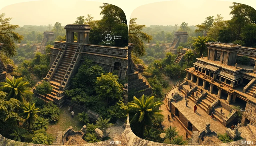
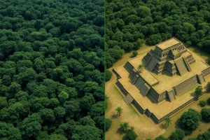
Immersive learning through Virtual Reality (VR) represents a paradigm shift in how Maya archaeology is taught, studied, and presented to the public. Traditionally, archaeological education relied on static two-dimensional maps, photographs, or physical models that could not fully convey the spatial complexity or temporal depth of ancient Maya cities. Today, digital heritage specialists utilize advanced scanning technologies, such as Light Detection and Ranging (LiDAR) and Structure from Motion (SfM), to create holistic landscapes of Mayan sites. These virtual environments allow students and researchers to link Mayan ruins between their current state and their past glory, discovering architectural beauty and historical richness without physically disturbing the site.
Main Explanation
The integration of VR into Maya archaeological education serves multiple critical functions: preservation, visualization, and pedagogical engagement. As there is an ongoing tension between the preservation of cultural heritage sites and the need for usable land, digital reconstruction offers a viable solution to document sites before they degrade or are lost to development. By digitally documenting site architecture and a selection of excavated artifacts, researchers can reconstruct sites during specific historical periods, such as the Classic Period (AD 250-900). This temporal layering allows learners to understand the evolution of a site over centuries.
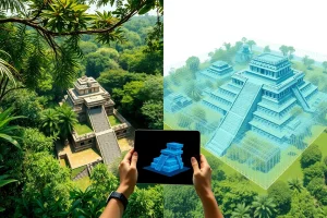
Furthermore, hardware advancements have begun to allow for broader consumer use of Virtual and Augmented Reality platforms in homes, schools, and museums. This democratization of access means that educational experiences are no longer confined to university laboratories or on-site visits. Instead, a 3D model and virtual experience can be created, methodologically explained, and examined to relate history, theory, and archaeological data to a global audience. The educational experience moves beyond passive observation; users can collect artifacts and evidence within the virtual space, actively linking the ruin to its historical context. This interactive element fosters a deeper cognitive connection to the material culture of the Maya.
The theoretical framework behind these applications often explores object identity and embodiment. While 3D visualization and modeling are not new concepts in archaeology, their combination in VR represents a growing body of research that seeks to understand how these tools help us study the people of the past. Unlike single object viewers that focus on visualizing individual artifacts, VR software employs recreated landscapes with multiple 3D objects. This employs Geographic Information Systems (GIS) and data to simulate ancient cities in a virtual space for immersive exploration, using the environment as a virtual lattice to understand urban planning and social organization.
Evidence & Sources
Recent academic literature provides concrete case studies demonstrating the efficacy of VR in Maya archaeology. In 2019, researchers presented an educational VR puzzle game set in an archaeological context at the site of Cahal Pech. They digitally documented the site architecture and artifacts using SfM mapping and reconstructed the site during the Classic Period based on current states and archaeological findings. The natural environment was created using procedural modeling, resulting in a holistic landscape where players could discover the site’s historical richness.
Similarly, a 2022 case study focused on the Maya site of Vista Alegre in Mexico. This thesis explored the applications of VR and Augmented Reality platforms specifically for public education. The project created a 3D model and virtual experience that was methodologically explained to relate history and theory. This work highlights how archaeological visualization relies on technological advancements to aid in recording, interpreting, and educating about sites and projects, moving beyond decades of computer graphics use to broader consumer hardware platforms.
Technical pipelines have also been developed to streamline this process. A 2022 study from UC San Diego presented an evolution of an existing system for reconstructing and displaying cultural heritage sites in VR environments. They developed a pipeline to track cameras using visual-inertial SLAM, perform 3D reconstruction using registered depth and RGB data, and facilitate loading the reconstruction in VR with virtual voice-guided tours. This automated pipeline demonstrates the ability to take an unskilled user from data capture to an immersive virtual tour without the need for extensive technical intervention.
Additionally, the MayaCityBuilder Project employs GIS and LiDAR data to simulate the ancient Maya city of Copan in a virtual space. This project utilizes recreated landscapes with multiple 3D objects rather than single models, allowing for the exploration of object identity and embodiment in a virtual Mayan city. These sources collectively confirm that VR is not merely a visualization tool but a rigorous methodological approach grounded in archaeological data.
Deep Dive Analysis
Module F: Digital Archaeology
Technology Description: The core technologies driving immersive Maya archaeology include LiDAR (Light Detection and Ranging), RGB-D cameras, and Structure from Motion (SfM) mapping. LiDAR uses laser pulses to measure distances, creating high-resolution topographic maps even through dense jungle canopy. RGB-D cameras capture color (RGB) and depth (D) data simultaneously, allowing for detailed surface texture mapping. SfM mapping derives 3D structures from a series of overlapping 2D photographs.
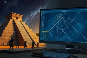
How It Works: These technologies function by capturing spatial data points that are subsequently registered into a coordinate system. For example, visual-inertial SLAM (Simultaneous Localization and Mapping) tracks cameras in real-time, aligning digital data with physical space. This data is processed to perform 3D reconstruction using registered depth and RGB data. The resulting mesh is then textured and optimized for real-time rendering in VR headsets.
Field Workflow: The workflow typically begins with data capture in the field using handheld scanners or drones. Researchers track the cameras using visual-inertial SLAM to ensure accurate positioning. Once captured, the data undergoes processing to create a registered 3D model. Finally, the reconstruction is loaded into a VR environment where virtual voice-guided tours can be layered over the spatial data.
Output/Data: The primary output is an immersive virtual tour or a holistic landscape of the Mayan site. This includes digitally documented site architecture, excavated artifacts, and reconstructed natural environments using procedural modeling. The data allows users to link the Mayan ruin between its current state and the past through collecting artifact and evidence.
Example: The reconstruction of Cahal Pech during the Classic Period (AD 250-900) serves as a prime example. Researchers reconstructed the site based on the current state and archaeological findings, creating a natural environment using procedural modeling. Another example is the simulation of the ancient Maya city of Copan using GIS and LiDAR data to create a virtual lattice for immersive exploration.
Strengths: The primary strength is the ability to preserve cultural heritage sites amidst the tension with land use needs. It allows for broader consumer use of VR platforms in homes, schools, and museums, democratizing access. It also enables the integration of individual technologies like scanning and modeling into a cohesive pipeline, taking an unskilled user from data capture to an immersive tour.
Limitations: Despite advancements, individual technologies have mostly been developed independently, and little effort has been dedicated to integrating them historically. There is also a reliance on hardware advancements which may not be universally available. Furthermore, single object viewers often focus on visualizing individual objects rather than the broader landscape, though VR mitigates this.
Accuracy: Accuracy is maintained by basing reconstructions on current states and archaeological findings. The use of registered depth and RGB data ensures that the digital models reflect the physical reality of the site. However, procedural modeling for natural environments involves some degree of interpretation based on ecological data.
Cultural Heritage Considerations: These efforts address the ongoing tension between the preservation of cultural heritage sites and the need for usable land. By creating digital assets, archaeologists ensure that sites like Vista Alegre and Cahal Pech are recorded even if physical access is restricted. This aligns with the goal of using technological advancements to aid in recording, interpreting, and educating about sites and projects without causing physical harm to the heritage.
FAQ
How does VR help preserve Maya sites?
VR creates digital duplicates of sites, allowing documentation and public access without physical wear or risk to the original heritage structures.
What time period is reconstructed at Cahal Pech?
The site is reconstructed during the Classic Period, specifically between AD 250 and 900.
Can unskilled users create VR tours?
Yes, automated pipelines have been developed to take an unskilled user from data capture to an immersive virtual tour.
Leave a Reply