
Short Answer
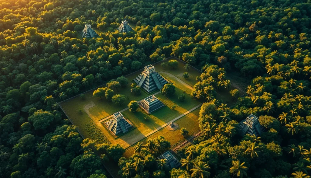
The dense tropical forests of Central America long obscured the true scale of ancient Maya civilization, leading researchers to underestimate population densities and urban sprawl. For decades, archaeological understanding relied on ground-based pedestrian surveys and selective excavation, which were limited by vegetation cover and accessibility. The introduction of airborne Light Detection and Ranging (LiDAR) technology has revolutionized this field, providing high-resolution topographic data that penetrates forest canopies to reveal the underlying terrain. This technological shift has allowed archaeologists to document large-scale human modifications to the landscape, fundamentally altering interpretations of Maya urban planning, agricultural intensity, and regional settlement dynamics.
Main Explanation
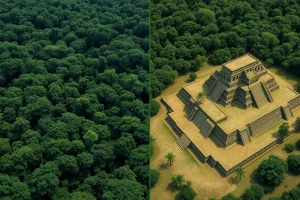
LiDAR operates by emitting laser pulses from an aircraft toward the ground and measuring the time it takes for the light to return. In the context of Maya archaeology, this technology is critical because it differentiates between vegetation canopy and the ground surface. Traditional remote sensing methods, such as satellite imagery, often fail in tropical environments because the forest cover hides archaeological features. LiDAR effectively strips away the forest digitally, generating a bare-earth model that exposes ruins, causeways, terraces, and residential platforms. This capability has shifted the archaeological paradigm from viewing Maya cities as isolated ceremonial centers surrounded by sparse populations to understanding them as densely populated, interconnected urban regions.
The impact of LiDAR is evident in the reassessment of settlement patterns. Prior to these surveys, many regions were thought to be lightly occupied. However, LiDAR data has demonstrated continuous occupation across landscapes previously considered uninhabited wilderness. This reveals a sophisticated level of urban planning where infrastructure such as raised causeways (sacbeob) and water management systems integrated distant settlements into cohesive political economies. The technology enables researchers to analyze spatial dynamics on a regional scale, providing insight into how the Maya modified their environment to support large populations over millennia.
Evidence and Sources
Empirical evidence from multiple major LiDAR surveys supports this revised understanding of Maya urbanism. One of the earliest and most influential applications occurred in western Belize at the site of Caracol. As documented in foundational research, airborne LiDAR was flown over a 200 km² area of the archaeological site. This survey successfully demonstrated large-scale human modifications made to the ancient tropical landscape, providing insight on broader regional settlement that was previously impossible to recover due to heavily forested cover. The data confirmed that Mayanists could not previously be sure how representative their mapped and excavated samples were relative to ancient settlement.
Further evidence emerges from northern Guatemala, where airborne laser scanning revealed ancient lowland Maya complexity. The Lowland Maya civilization flourished in the tropical region of the Yucatan peninsula and environs for more than 2500 years, roughly from 1000 BCE to 1500 CE. Despite being known for sophistication in writing, art, architecture, astronomy, and mathematics, the civilization posed questions about the nature of its cities because of its location in an inaccessible forest. A significant survey conducted in 2016 addressed this by scanning northern Guatemala, confirming high-density settlement patterns that challenged earlier low-population estimates.
More recent work continues to refine these models. A study published in October 2025 focused on Classic Maya urbanism at Dzibanche/Kaanu’l through airborne LiDAR mapping. This project covered a 103 km² aerial lidar survey area, allowing for a closer look at urban and peri-urban settlement features. Additionally, research in the Upper Usumacinta River Region of Mexico and Guatemala, published in 2021, utilized airborne LiDAR survey combined with density-based clustering to analyze ancient Maya settlement. Authors including Charles J. Golden and A. Scherer contributed to this work, highlighting how digital clustering techniques can identify settlement patterns in complex riverine environments.
Deep Dive Analysis
Technology Description
LiDAR (Light Detection and Ranging) is a remote sensing method that uses light in the form of a pulsed laser to measure ranges (variable distances) to the Earth. In archaeological applications, it is typically mounted on aircraft or drones. The system records the intensity of the return signal and the precise GPS location of each pulse. For Maya archaeology, the key metric is the ability of the laser pulses to penetrate gaps in the vegetation canopy and reflect off the ground surface.
How It Works
The process begins with flight planning over a target region, such as the 200 km² area flown over Caracol. As the aircraft flies, the LiDAR sensor emits hundreds of thousands of laser pulses per second. Some pulses hit leaves and branches, while others reach the ground. Post-processing software classifies these returns, filtering out the vegetation points to create a Digital Terrain Model (DTM). This DTM represents the bare earth, revealing anthropogenic features that are otherwise invisible.
Field Workflow
The workflow involves coordination between aviation specialists, data processors, and archaeologists. First, the region is defined, such as the 103 km² area at Dzibanche/Kaanu’l. After data acquisition, raw point clouds are processed to remove noise and classify ground points. Archaeologists then interpret the resulting hillshade models and slope maps to identify potential structures. Ground truthing follows, where teams visit specific coordinates to verify the digital findings with physical excavation or survey.
Output and Data
The primary output is a high-resolution topographic map. This data allows for the visualization of causeways, plazas, and residential groups. In the Upper Usumacinta River Region, this data supported density-based clustering analysis, enabling researchers to statistically define settlement zones rather than relying on subjective visual inspection. The data availability statements in recent publications indicate that these datasets are increasingly being shared for broader academic use.
Example Case Studies
The Caracol project in Belize serves as a primary example, where LiDAR effectively provided ground as well as forest cover information, leading to a much fuller documentation of the complexities involved in the ancient human-nature interface. Similarly, the 2016 northern Guatemala survey revealed that the civilization’s location in an inaccessible forest had previously hindered full coverage and documentation of Maya sites. The Dzibanche survey in 2025 further illustrated Classic Maya urbanism, showing how peri-urban features extend far beyond ceremonial cores.
Strengths
The primary strength of LiDAR is its ability to cover large areas quickly and penetrate dense vegetation. Before the advent of this laser-based technology, heavily forested cover prevented full coverage and documentation of Maya sites. It allows for the identification of features too subtle to be seen from the ground, such as low agricultural terraces or eroded causeways. It also provides a permanent digital record of the landscape, which is crucial as modern development threatens archaeological sites.
Limitations
Despite its power, LiDAR has limitations. It cannot date structures; it only reveals morphology. A mound identified as a pyramid might be natural without excavation. Additionally, data processing is computationally intensive and requires specialized expertise. The cost of airborne surveys can be prohibitive for smaller projects, though drone-based LiDAR is becoming more accessible. Furthermore, dense undergrowth in some areas can still obscure fine details if the laser pulse density is not high enough.
Accuracy
Modern airborne LiDAR systems offer vertical accuracy within 10 to 20 centimeters, which is sufficient to identify most architectural features. However, accuracy depends on flight altitude and pulse density. In the Upper Usumacinta study, density-based clustering relied on this accuracy to distinguish between random natural variations and deliberate human construction. Researchers must calibrate data against ground control points to ensure spatial precision.
Cultural Heritage Considerations
The use of LiDAR raises important cultural heritage considerations. While it minimizes physical disturbance, the publication of precise site locations can inadvertently aid looters. Researchers like Francisco Estrada-Belli and Charles J. Golden must balance data availability with site protection. Additionally, interpreting these landscapes requires collaboration with descendant communities to ensure that the narrative of “discovery” respects indigenous history and knowledge. The technology reveals the scale of labor invested by ancient populations, highlighting the sophistication of their engineering and social organization.
FAQ
Why was LiDAR necessary for Maya archaeology?
Heavily forested cover prevented full coverage and documentation of Maya sites using traditional ground surveys. LiDAR penetrates the canopy to reveal structures hidden beneath.
Does LiDAR replace excavation?
No. LiDAR identifies potential features and settlement patterns, but excavation is still required to date structures and understand their function.
What regions have been surveyed?
Major surveys include western Belize (Caracol), northern Guatemala, the Upper Usumacinta River Region, and Dzibanche/Kaanu’l in Mexico.
How accurate is the LiDAR data?
Modern airborne systems offer vertical accuracy within 10 to 20 centimeters, sufficient to identify architectural features like pyramids and causeways.



Leave a Reply