
Short Answer
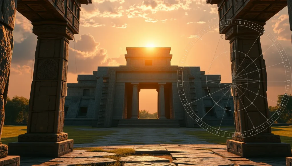
The verification of astronomical alignments in ancient Maya architecture has traditionally relied on on-site surveys and static ground plans. However, the emergence of digital sky simulation technologies has revolutionized this field, allowing researchers to interactively investigate orientations under accurate sky simulations. By integrating three-dimensional models into desktop planetarium software, archaeologists can now visualize how celestial bodies interacted with built environments in the past. This digital approach bridges the gap between archaeological data and astronomical computation, providing a dynamic method for testing hypotheses about Maya cosmology and architectural intent.
Main Explanation
Digital sky simulation involves the use of specialized software to recreate the appearance of the sky at specific locations and times in history. In the context of Maya archaeology, this technology is used to determine whether structures were intentionally aligned with celestial events such as solstices, equinoxes, or planetary cycles. The core of this methodology lies in the ability to render the local horizon for a terrestrial observer and track the paths of celestial objects with sufficient precision for historical times. Unlike popular consumer astronomy apps, professional-grade tools used in cultural astronomy incorporate open-source software tools and geographical data to ensure accuracy.
The process typically begins with the creation of a digital model of the archaeological site. This model is then imported into a planetarium environment where the sky can be manipulated across time. Researchers can observe sunrise and sunset points on specific dates, such as the spring equinox, from the perspective of an ancient observer standing within the structure. This interactive exploration allows for the testing of multiple hypotheses without the need for physical presence at the site, which is particularly valuable for locations that are inaccessible or have been altered by modern vegetation and construction. The precision of these simulations is critical, as even minor deviations can invalidate claims of intentional astronomical orientation.
Evidence & Sources
Recent academic literature provides robust evidence for the efficacy of digital sky simulation in archaeoastronomy. Research indicates that planetarium software such as Stellarium has been used to simulate sky conditions with precision as good as one degree for time periods dating back as far as 4000 BC. This level of accuracy is sufficient for analyzing Maya structures, which often exhibit alignments within this margin of error. The integration of plugins allows for the loading of 3D models, facilitating interactive investigation of orientations under a good sky simulation.
Specific case studies highlight the practical application of these tools. For instance, investigations at the site of Cerros, Belize, utilized three-dimensional reconstructions based on recorded archaeological data to explore ancient astronomical systems of knowledge. Researchers argued that the ancient Maya of Cerros observed features in the coastal landscape that marked zenith events, later constructing buildings to memorialize these observation points. As the site grew, the system of observation developed into a form of architecture that only elites could access, creating a separate privileged form of knowledge. Later construction marked other important horizon events, most notably the spring equinox, demonstrating how architecture became a form of landscape that helped mould ceremonial activities.
Furthermore, the development of dedicated cultural astronomy software tools has been documented as a significant step forward. These tools render the local horizon and sky tracks of celestial objects that are of interest in cultural astronomy. Unlike generic planetarium software, these specialized applications are designed to handle the specific geographical and historical data required for rigorous archaeological analysis. The combination of photorealistic panoramas imported into simulation software offers opportunities for conveying realism and allowing for a fuller experience of temporal rhythms that enforce the skyscape experience.
Deep Dive Analysis
Technology Description
The primary technology employed in this field is desktop planetarium software, specifically open-source platforms like Stellarium. These programs simulate the night sky based on astronomical algorithms. For archaeoastronomical purposes, these platforms are extended through plugins that support the importation of three-dimensional architectural models and terrain data. This transforms the software from a simple star chart into a virtual reconstruction environment where the built environment and the sky coexist.
How It Works
The simulation works by calculating the position of celestial bodies based on precise ephemerides for any given date and time. When a 3D model of a Maya temple is loaded into the software, the user can place a virtual camera at specific viewpoints, such as a doorway or a rooftop observatory. The software then renders the horizon line defined by the model and the surrounding terrain. By advancing time, the user can watch the sun, moon, or planets rise and set relative to the architectural features. This allows for the identification of alignment dates where a celestial body aligns perfectly with a structural axis.
Field Workflow
The workflow begins with archaeological surveying. Researchers must first obtain accurate geographical data and architectural measurements of the site. This data is used to construct the 3D model. Once the model is complete, it is imported into the simulation software. The researcher then sets the geographical coordinates and the historical date range of interest. Simulations are run to identify potential alignment events. These digital findings are then cross-referenced with archaeological evidence, such as artifact placement or inscriptional data, to validate the astronomical hypothesis.
Output/Data
The output of these simulations includes visual records of sky events, such as screenshots or video captures of sunrises over specific temples. Quantitative data is also generated, including azimuth and altitude measurements of celestial bodies at the moment of alignment. This data can be statistically analyzed to determine if the observed alignments are likely due to chance or intentional design. The visual output is particularly useful for public engagement and educational purposes, providing a vivid representation of ancient skyscapes.
Example
A prominent example of this methodology is the work conducted at Preclassic Cerros, Belize. Using three-dimensional reconstructions of the site based on recorded archaeological data, researchers focused on how the Maya at Cerros developed an astronomically influenced cosmological system. They argued that the ancient Maya early on observed features in the coastal landscape that marked zenith events. Over time, they constructed buildings to memorialize this observation point on a unique promontory at the site. The simulation allowed researchers to visualize how the architecture itself became a form of landscape that helped mould their ceremonial activities.
Strengths
The primary strength of digital sky simulation is its ability to isolate variables. Researchers can remove modern obstructions like trees or buildings to see the original horizon. It also allows for the rapid testing of multiple dates and orientations without the cost and time associated with field campaigns. The precision of the sky simulated using these tools is shown to be highly reliable for historical periods. Additionally, the opportunity photorealistic panorama imported into the software has in conveying realism allows for a fuller experience of temporal rhythms.
Limitations
Despite its strengths, the technology has limitations. The accuracy of the simulation depends heavily on the accuracy of the 3D model. If the architectural reconstruction is flawed, the alignment results will be misleading. Furthermore, simulations cannot fully account for atmospheric conditions such as haze or cloud cover that would have affected visibility in the past. Vegetation changes over millennia can also alter the horizon profile, which must be estimated rather than known with certainty. Research requires on-site surveys and computation, and usually relevant directions are only published as simple arrows in ground plans, which can limit the initial data quality.
Accuracy
The precision of the sky simulated using standard planetarium software is shown to be as good as one degree for time periods dating back as far as 4000 BC. This level of accuracy is generally sufficient for archaeoastronomical purposes, as most ancient alignments fall within a few degrees of the true astronomical event. However, claims of extreme precision should be treated with caution. The software renders the local horizon and sky tracks with sufficient precision for historical times, but users must remain aware of the margin of error inherent in both the software and the archaeological data.
Cultural Heritage Considerations
The use of digital simulations raises important considerations regarding cultural heritage. Virtual reconstructions must be grounded in archaeological evidence to avoid perpetuating misconceptions. There is a risk that photorealistic simulations may be interpreted as absolute truth rather than hypothesis. Researchers argue that exploring and engaging with the skyscape is an important method for developing meaning in the context of archaeoastronomical findings, but this must be done responsibly. The architecture itself became a form of landscape that helped mould their ceremonial activities, and digital tools should respect this cultural context rather than reducing it to mere geometric alignments.
FAQ
How accurate are digital sky simulations for ancient dates?
The precision of the sky simulated using software like Stellarium is shown to be as good as one degree for time periods dating back as far as 4000 BC.
What software is used for Maya astronomical verification?
Researchers use open-source desktop planetarium software such as Stellarium, often with plugins that allow loading of 3D models.
Can simulations replace on-site archaeological surveys?
No, research still requires on-site surveys and computation; simulations are used to interactively investigate orientations based on that data.



Leave a Reply