
Short Answer
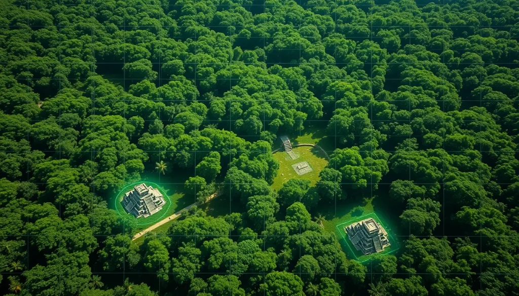
For centuries, the dense forests of Central America concealed the true extent of the Maya civilization. Traditional archaeological methods required grueling expeditions through heat, humidity, and dangerous wildlife to manually clear vegetation and map ruins. However, a technological revolution is currently upending everything researchers thought they knew about the ancient Maya. Light Detection and Ranging (LiDAR) technology is now allowing scientists to digitally remove the forest canopy, revealing sprawling urban networks that were previously invisible to the naked eye.
This shift from machetes to lasers has expedited the pace of discovery, turning the uncovering of lost cities into a more common phenomenon. The implications are profound, suggesting a civilization far more populous and interconnected than previously imagined. As archaeologists huddle around computers in air-conditioned offices rather than hacking through jungles, they are rewriting the history of one of the world’s most sophisticated ancient cultures.
Main Explanation
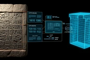
LiDAR technology operates by emitting laser pulses from an aircraft toward the ground. These pulses penetrate gaps in the vegetation canopy and reflect off the ground surface and any structures beneath it. By measuring the time it takes for the light to return, sensors create precise three-dimensional maps of the terrain. This process effectively strips away the jungle digitally, exposing architectural features such as pyramids, plazas, causeways, and reservoirs that have been swallowed by the forest for over a millennium.
The application of this technology in Mesoamerica has revealed that Maya cities were not isolated ceremonial centers but part of vast, interconnected urban settlements. The scale of these discoveries challenges previous population estimates and models of agricultural sustainability. Where archaeologists once saw isolated ruins, LiDAR reveals continuous urban sprawls covering hundreds of square miles. This sophistication indicates a high level of political organization and labor coordination required to construct such extensive infrastructure.
Furthermore, the technology allows researchers to identify specific architectural arrangements that indicate chronological periods and political functions. For instance, the presence of an E-Group assemblage, a specific architectural layout, generally indicates a founding date prior to AD 150. These digital insights guide ground teams to specific coordinates for verification, optimizing resources and minimizing physical disturbance to the fragile ecosystem and archaeological sites.
Evidence & Sources
Recent years have witnessed a cascade of major announcements supported by LiDAR data. In February 2024, National Geographic reported on findings in Mexico’s Yucatan where LiDAR revealed that the Maya city of Dzibanche sprawled more than seven square miles. This discovery was made by archaeologists with research posts at Tulane University, who noted the irony that their biggest discovery came while analyzing data in an office rather than in the field.
Later in 2024, a study published in the journal Antiquity by Luke Auld-Thomas and colleagues from Cambridge University Press detailed the discovery of Valeriana. Located in the southeastern state of Campeche, this lost city was named after a nearby freshwater lagoon. The site features monumental structures including temple pyramids, a ball court, and a reservoir formed by damming an arroyo. The architectural hallmarks suggest it was a classic Mayan political capital founded before 150 AD.
Prior to these findings, in August 2023, NPR reported on the discovery of the Maya city of Ocomtun in Mexico’s central Yucatan Peninsula. Scientists described the find as monumental, noting that light-mapping technology was expediting the pace of discovery to the point where finding a lost city was becoming common enough to be the subject of jokes among researchers. Additionally, a groundbreaking project undertaken in 2016, led in part by Stephen Houston of Brown University, surveyed 2,100 square kilometers of Guatemalan forest. Published in Science, this work drastically altered the prevailing view of the scale and complexity of the Maya civilization, revealing extensive infrastructure and interconnected urban settlements.
Deep Dive Analysis
Technology Description
LiDAR (Light Detection and Ranging) is a remote sensing method that uses light in the form of a pulsed laser to measure ranges (variable distances) to the Earth. In the context of Maya archaeology, airborne LiDAR is mounted on planes or drones to survey large areas of inaccessible tropical forest.
How It Works
The system emits rapid pulses of laser light at the surface. Some pulses reflect off the top of the tree canopy, while others penetrate through gaps in the leaves and branches to hit the ground or man-made structures. The sensor records the time delay between emission and return. Since the speed of light is constant, this time difference calculates the distance. By compiling millions of these points, a point cloud is generated. Algorithms then classify these points to separate vegetation from ground features, creating a Digital Elevation Model (DEM) that shows the bare earth topology.
Field Workflow
The workflow begins with planning flight paths over target regions, often in remote areas of Campeche, Guatemala, or Belize. Once the data is collected, it undergoes intensive processing to filter out noise and vegetation. Archaeologists analyze the resulting imagery to identify anomalies indicative of human construction, such as rectilinear shapes or elevated platforms. Finally, ground teams are dispatched to specific coordinates to verify the digital findings through traditional excavation and surveying.
Output and Data
The primary output is a high-resolution topographic map that reveals micro-topography invisible from the ground. This includes causeways (sacbeob), defensive fortifications, agricultural terraces, and water management systems. The data allows for the measurement of structure heights and volumes without physical contact.
Example Cases
The city of Valeriana serves as a prime example, where LiDAR identified enclosed plazas connected by a broad causeway and a probable E-Group assemblage. Similarly, the Ocomtun discovery highlighted how laser mapping could locate monumental cities in the central Yucatan. The 2016 Guatemala survey revealed that the Maya civilization flourished for 2,500 years with a density of settlement that rivaled contemporary civilizations elsewhere in the world.
Strengths
The primary strength of LiDAR is its ability to cover vast, inaccessible areas quickly. It reduces the time required for preliminary surveys from years to weeks. It is non-invasive, preserving the site integrity until targeted excavation is deemed necessary. It also reveals landscape context, showing how cities interacted with their environment, such as the reservoir at Valeriana formed by damming a seasonal watercourse.
Limitations
Despite its power, LiDAR cannot date structures on its own; ground truthing is essential to recover artifacts like ceramics or inscriptions that provide chronological context. The technology is also expensive, requiring specialized aircraft and processing software. Dense vegetation can sometimes obscure smaller features if the canopy is too thick for laser penetration.
Accuracy
Modern airborne LiDAR systems offer vertical accuracy within 10 to 20 centimeters. This precision allows archaeologists to distinguish between natural hills and constructed pyramids. However, interpretation still requires human expertise to differentiate geological features from architectural ones.
Cultural Heritage Considerations
The publication of precise location data carries risks. As noted in reports regarding the dangers of armed looters in Central America, revealing exact coordinates of unguarded sites can invite illicit excavation. Researchers must balance the scientific imperative to share knowledge with the ethical duty to protect heritage sites from looting and destruction. The irony noted by Tulane University researchers highlights this shift; while technology makes discovery easier, it also necessitates new protocols for site security in the digital age.
FAQ
How does LiDAR see through the jungle?
LiDAR emits laser pulses that penetrate gaps in the vegetation canopy. Some pulses reflect off leaves, but others reach the ground, allowing sensors to map the surface beneath the trees.
What was the city of Valeriana named after?
The city was named after a nearby freshwater lagoon located in the southeastern state of Campeche, Mexico.
Does LiDAR replace traditional excavation?
No, LiDAR identifies potential sites, but ground verification and excavation are still required to recover artifacts and determine precise dates.
Who led the groundbreaking 2016 Guatemala survey?
The project was helped led by Stephen Houston, a professor of social sciences at Brown University, among a team of researchers.


Leave a Reply