
Short Answer
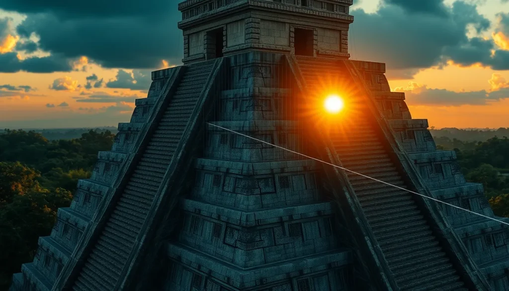
El Caracol, often referred to as the Observatory, remains one of the most enigmatic and architecturally distinct structures at the ancient Maya site of Chichén Itzá. For centuries, scholars have debated the precise function of this round tower, whose spiral staircase and skewed platform suggest a purpose beyond standard civic or religious use. While early archaeologists like Sylvanus Morley documented the ruin in the 1920s, the decay of the upper tower obscured the specific geometric relationships embedded in its design. Today, the intersection of archaeology and digital heritage offers a revolutionary solution. By utilizing 3D digital models, researchers can virtually restore the structure to its original state, allowing for the precise recalibration of astronomical sightlines that have been lost to time and erosion.
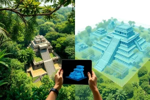
The application of digital modeling does more than create a visual representation; it serves as a scientific tool for archaeoastronomy. Through photogrammetry and laser scanning, specialists can reconstruct the missing portions of the tower’s upper drum and window shafts. This digital restoration enables the simulation of celestial events as they would have appeared from the interior viewing positions over a millennium ago. By aligning virtual cameras with the reconstructed apertures, researchers can test hypotheses regarding the building’s orientation against the extremes of Venus, the equinox sunset, and lunar standstills without physically altering the fragile ruins.
Main Explanation
The core challenge in understanding El Caracol lies in its current state of preservation. The structure consists of a round tower set upon a double rectangular platform, but the uppermost section has suffered significant decay. Originally, the tower resembled a double-decker configuration with specific openings designed as viewing shafts. As noted by archaeological surveys, three openings survive in the half-ruined higher tower, yet their irregular placement suggests they were engineered for specific azimuths rather than general ventilation or light. Without the complete architectural context, determining the exact line of sight through these shafts is difficult using traditional surveying methods alone.
3D digital models address this by creating a metrically accurate virtual twin of the structure. This process begins with data capture, where thousands of overlapping photographs or laser scan points are collected from the physical site. Software then processes this data into a dense point cloud, which is converted into a mesh surface. Archaeologists and digital heritage specialists can then manipulate this mesh to fill in gaps based on architectural symmetry and comparative analysis with better-preserved Maya structures. Once the virtual model is restored to its hypothesized original form, virtual sightlines can be drawn from the interior observation points to the horizon.
These digital sightlines are critical for validating the archaeoastronomical theories proposed in the 20th century. For instance, the building’s corners are aligned not to the cardinal directions, like most Maya civic architecture, but to a set of angles that respect a different geometry altogether. Digital tools allow researchers to measure these angles with sub-degree precision, confirming whether they track the extremes of Venus’s 584-day cycle or the major lunar standstill. This virtual experimentation preserves the physical integrity of the site while providing robust data on Maya cosmological knowledge.
Evidence & Sources
The foundational evidence for El Caracol’s astronomical function was established long before the advent of modern 3D modeling. In the 1920s, the Carnegie Institution team led by Sylvanus Morley photographed the ruin, sparking decades of inquiry into its unique geometry. However, the definitive scientific breakthrough occurred in 1975 when Anthony Aveni, Sharon Gibbs, and Horst Hartung published their seminal paper in Science. Their measurements documented that the three surviving upper window openings were not arbitrarily placed. They identified that several window openings and diagonal sightlines through the building’s corners aligned with the extreme northerly and southerly setting positions of Venus across its eight-year cycle.
Further evidence supports the alignment with solar and lunar events. One window sightline frames the equinox sunset, a critical marker for the Maya agricultural and ritual calendar. Additionally, a diagonal across two corners of the building’s upper platform points near the azimuth of the moon’s maximum southerly setting at the major lunar standstill. These were the first sub-degree alignment measurements ever published for a Mesoamerican building, establishing a high standard for archaeoastronomical research. A stele on the upper platform dates the building to 906 AD, indicating its significant place in Mayan history during the Terminal Classic period.
Modern digital models build upon this foundational data. While Aveni and Hartung used theodolites and manual calculations, contemporary researchers use digital terrain models to reconstruct the horizon as it existed in 906 AD, accounting for vegetation growth and landscape changes. The digital restoration confirms that the tower’s elevated position was designed to provide 360-degree views of the skies above the surrounding jungle canopy. This synthesis of historical measurement and modern technology reinforces the consensus that El Caracol was central to Mayan astronomical studies, enabling the ancient civilization to observe celestial movements and predict seasonal changes.
Deep Dive Analysis
Module F: Digital Archaeology
Technology Description
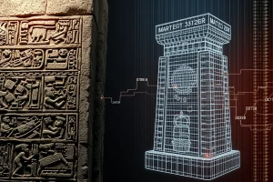
The primary technologies employed in restoring El Caracol’s sightlines are terrestrial laser scanning (LiDAR) and photogrammetry. LiDAR uses laser pulses to measure distances to the surface of the structure, creating a highly accurate point cloud. Photogrammetry uses overlapping photographs to generate 3D geometry through computer vision algorithms. Both methods produce metric data suitable for archaeological analysis.
How It Works
In the field, scanners are positioned around El Caracol to capture every visible surface. For photogrammetry, drones or handheld cameras capture images from multiple angles. Back in the laboratory, software aligns these data points to create a textured 3D mesh. Archaeologists then use modeling software to digitally “repair” the decayed sections of the tower based on architectural evidence. Virtual cameras are placed inside the restored windows to project lines of sight onto a digital horizon map.
Field Workflow
The workflow begins with site permission and safety assessment, followed by data capture during optimal lighting conditions to minimize shadows. Control points are established on the ground to georeference the model to real-world coordinates. Data is processed in stages: alignment, dense cloud generation, mesh creation, and texturing. Finally, the astronomical analysis layer is added, integrating celestial movement software with the architectural model.
Output/Data
The primary output is a georeferenced 3D model compatible with GIS and astronomical simulation software. Data products include deviation maps showing where the current ruin differs from the restored model, azimuth tables for window alignments, and visualizations of celestial events viewed from within the tower. These datasets are often archived for future research and public education.
Example
A prime example is the virtual reconstruction of the upper drum’s missing windows. By mirroring the surviving shafts and applying the geometric ratios identified by Aveni in 1975, digital specialists can simulate the view of Venus rising at its northern extreme. This allows researchers to verify if the reconstructed aperture perfectly frames the planet’s horizon position without physical intervention.
Strengths
Digital models are non-invasive, preserving the physical fabric of the heritage site. They allow for reversible experiments; if a reconstruction hypothesis is proven wrong, the model can be adjusted without damaging the ruin. Furthermore, they facilitate remote collaboration, allowing astronomers and archaeologists to analyze the sightlines from anywhere in the world.
Limitations
The accuracy of the sightline restoration depends on the accuracy of the reconstruction hypothesis. If the original roof height or window shape is misinterpreted, the digital sightline will be incorrect. Additionally, digital models cannot fully account for atmospheric conditions or the exact state of the horizon vegetation in 906 AD, which may have influenced visibility.
Accuracy
Modern photogrammetry can achieve millimeter-level accuracy for surface geometry. However, astronomical alignment accuracy depends on the georeferencing of the model to true north and the precision of the horizon reconstruction. When combined with historical data from the 1975 Aveni study, digital models provide sub-degree alignment verification.
Cultural Heritage Considerations
Digital heritage projects must respect the cultural significance of the site to descendant communities. The data should be managed ethically, ensuring that virtual restorations do not misrepresent Maya history or promote pseudoscience. Collaboration with local stakeholders ensures that the digital narrative aligns with cultural values and archaeological integrity.
FAQ
Why is El Caracol called the Observatory?
It is called the Observatory because its windows and platform corners align with celestial events like Venus extremes and equinox sunsets, indicating it was used for astronomical observation.
How do 3D models help archaeologists study El Caracol?
3D models allow researchers to virtually reconstruct decayed parts of the tower and simulate ancient sightlines without physically touching or altering the fragile ruins.
What celestial bodies were tracked from El Caracol?
Observers tracked Venus across its 584-day cycle, the sun during equinoxes, and the moon during major lunar standstills.
When was El Caracol built?
A stele on the upper platform dates the building to 906 AD, placing it in the Terminal Classic period of Maya history.
Leave a Reply