
Short Answer
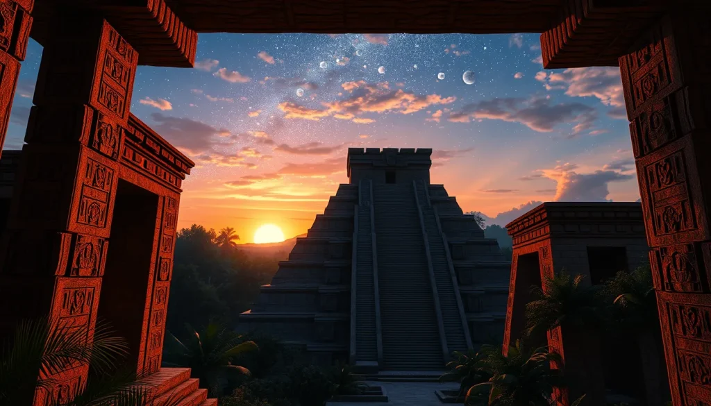
The question of whether digital heritage tools can simulate ancient Maya sky views is central to modern archaeoastronomy. For centuries, the rich nocturnal environment of the starry sky could be modelled only by analogue tools such as paper planispheres, atlases, globes, and numerical tables. Today, desktop planetarium programs and virtual reality environments have revolutionized this field. These tools allow researchers to visualize the sky as it appeared over Mesoamerica during the Preclassic and Classic periods, providing critical insights into Maya cosmology, architecture, and ritual practices. By combining precise astronomical algorithms with reconstructed landscapes, digital heritage specialists can test hypotheses regarding architectural orientations and celestial alignments.
Main Explanation
Digital heritage tools simulate ancient sky views by calculating the positions of celestial objects based on specific dates and geographical coordinates in the past. The core technology relies on astronomical models that account for phenomena such as precession, nutation, and proper motion of stars. Software like Stellarium has become a standard in cultural astronomy research, offering immersive sky simulations that replace costly optomechanical planetariums. These programs run on personal computers and provide wide attention due to their accessibility and accuracy. They render the local horizon for a terrestrial observer and the sky tracks of celestial objects that are of interest in cultural astronomy, with sufficient precision for historical times.
Furthermore, three-dimensional reconstructions of archaeological sites are integrated into these simulations. Using recorded archaeological data, researchers focus on how the Maya developed astronomically influenced cosmological systems. For instance, virtual reconstructions allow users to stand within a digital replica of a temple and observe horizon events such as solstitial sunrises or zenith passages. This integration transforms static ruins into dynamic observational platforms. However, it is crucial to distinguish between the simulation capabilities and the archaeological evidence. While the software can accurately compute planetary positions, the reconstruction of the ancient landscape, including vegetation and building heights, relies on interpretative archaeological data.
Evidence & Sources
Recent academic publications provide robust evidence for the efficacy of these tools. A study published in the Journal of Skyscape Archaeology details the use of Stellarium for cultural astronomy research, highlighting its transition from an educational tool to a research instrument. Authors such as Georg Zotti and Susanne M. Hoffmann have documented how modern incarnations of desktop planetarium programs gain wide attention for their ability to model the sky for historical times. Another significant investigation explores the emergence of ancient astronomical systems of knowledge at the site of Cerros, Belize. Researchers argue that the ancient Maya of Cerros early on observed features in the coastal landscape that marked zenith events. Using three-dimensional reconstructions of the site based on recorded archaeological data, they demonstrated how the architecture itself became a form of landscape that helped mould ceremonial activities.
Additionally, efforts to obtain dedicated cultural astronomy software have been documented. Researchers from the National Autonomous University of Honduras introduced tools that render local horizons using open-source software tools and geographical data. This ensures that simulations are not dependent on proprietary black-box algorithms. In the realm of virtual archaeology, studies note that most 3D editing systems used to build virtual reconstructions of monuments fail to provide astronomically accurate solar illumination models. To address this, new systems have been created to recreate the slightly different solar positions of antiquity or even prehistory. These developments confirm that while challenges exist, the technology is maturing to meet the rigorous demands of archaeoastronomical inquiry.
Deep Dive Analysis
Technology Description
The primary technologies involved include desktop planetarium software, virtual reality (VR) engines, and geographic information systems (GIS). Desktop planetarium programs simulate the celestial sphere, while VR engines render the terrestrial environment. Together, they create a mixed-reality experience where the user can observe the interaction between architecture and the sky. These tools are often built on open-source software tools, allowing for transparency in the computational methods used to determine celestial positions.
How It Works
The simulation process begins with inputting the geographical coordinates of the archaeological site. The software then applies astronomical models to calculate the positions of the sun, moon, planets, and stars for a specific historical date. This requires accounting for precession, which shifts the position of the equinoxes over centuries. The software renders the local horizon, taking into account topographical data. Unlike popular consumer applications, research-grade tools ensure sufficient precision for historical times by utilizing established astronomical ephemerides. The immersive sky simulator provides new ways for representing and teaching about the sky, overcoming the high construction and running costs of traditional optomechanical planetariums.
Field Workflow
The workflow typically involves collaboration between archaeologists and digital specialists. First, archaeological data is recorded, including building orientations and landscape features. This data is used to build virtual reconstructions of the site. Next, astronomical data is computed from modern astronomical models. These two datasets are merged within the digital environment. Researchers then explore orientation patterns using digital reconstructions and positions of celestial objects. This process allows for the testing of hypotheses regarding sacred architecture and monuments which often show correlation to astronomical events like solstitial sunrises.
Output/Data
The output consists of visual simulations, often in the form of video renderings or interactive VR experiences. These outputs show sky tracks of celestial objects and their relationship to the built environment. Data includes azimuth and altitude measurements for celestial events relative to architectural features. In the case of Cerros, Belize, the investigation explored how the system of observation developed into a form of architecture that only elites could access. The output helps visualize how this created a separate privileged form of knowledge.
Example
A prime example is the reconstruction of the site at Cerros, Belize. Researchers used three-dimensional reconstructions based on recorded archaeological data to focus on how the Maya developed an astronomically influenced cosmological system. They argued that over time, buildings were constructed to memorialize observation points on a unique promontory. Later construction marked other important horizon events, most notably the spring equinox. Another example involves the use of Stellarium to model sky views for specific dates in the Maya Long Count calendar, verifying alignments at sites like Chichén Itzá.
Strengths
The primary strength is accessibility and cost-effectiveness. Desktop planetarium programs running on personal computers have gained wide attention because they are affordable compared to physical planetariums. They allow for rapid testing of multiple hypotheses regarding dates and orientations. Furthermore, they provide an immersive environment that helps researchers and the public understand the visual experience of the ancient Maya. The use of open-source software tools ensures that methods can be verified by the broader scientific community.
Limitations
Despite advancements, limitations remain. Most 3D editing systems used to build virtual reconstructions of such monuments fail to provide astronomically accurate solar illumination models. They often cannot recreate the slightly different solar positions of antiquity or even prehistory accurately. Additionally, any usable representation of the night sky depends on the accuracy of the underlying astronomical models and the reconstruction of the horizon. Vegetation growth and atmospheric conditions in the past are difficult to model precisely. The high construction and running costs of physical验证 systems are avoided, but digital fidelity requires significant computational resources.
Accuracy
Accuracy is sufficient for historical times when using specialized tools. New software tools render the local horizon and sky tracks with sufficient precision for historical times. However, users must be aware that standard gaming engines may not prioritize astronomical accuracy over visual fidelity. Research-grade systems created independently by authors in the field aim to correct this by integrating precise astronomical models. The precision depends on the quality of the archaeological data used to reconstruct the horizon and buildings.
Cultural Heritage Considerations
When simulating ancient sky views, it is vital to avoid pseudoscience. Claims must be grounded in archaeological evidence rather than modern spiritual interpretations. The architecture itself became a form of landscape that helped mould ceremonial activities, and simulations should reflect this functional relationship. Researchers must distinguish between historical Maya beliefs and modern interpretations. The goal is to understand the emergence of ancient astronomical systems of knowledge, not to validate modern astrological claims. Digital heritage tools should be used to explore how the Maya observed features in the coastal landscape that marked zenith events, respecting the cultural context of these observations.
FAQ
Can software accurately show the sky from 1000 years ago?
Yes, specialized software accounts for precession and proper motion to render sky tracks with sufficient precision for historical times.
What is the main limitation of these simulations?
Many 3D editing systems fail to provide astronomically accurate solar illumination models for antiquity.
How is archaeological data used in these tools?
Recorded archaeological data is used to build three-dimensional reconstructions of the site and landscape.
Leave a Reply