
Short Answer
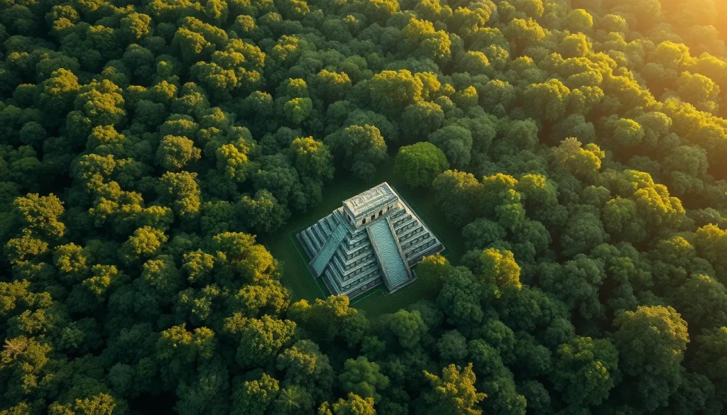
For centuries, the dense jungles of Central America concealed the true extent of the Maya civilization. Traditional archaeological methods, reliant on ground surveys and excavation, were severely limited by inaccessible terrain, grueling heat, and thick vegetation. However, a technological revolution has recently upended everything researchers thought they knew about the ancient Maya. Light Detection and Ranging, commonly known as LiDAR, is now allowing archaeologists to digitally strip away the forest canopy, revealing staggering urban scales and sophisticated infrastructure that were previously invisible to the naked eye.
This digital heritage breakthrough has transformed the understanding of Maya population density, agricultural capacity, and political organization. What once appeared as isolated ruins are now understood to be interconnected megacities sprawling across thousands of square kilometers. As researchers from institutions like Tulane University and Brown University continue to analyze aerial laser data, the map of the ancient Maya world is being redrawn with unprecedented precision.
Main Explanation
LiDAR technology operates by emitting laser pulses from an aircraft toward the ground. These pulses penetrate gaps in the vegetation canopy and reflect off the ground surface below. By measuring the time it takes for the laser to return, sensors create a high-resolution three-dimensional map of the terrain. This process effectively removes the visual obstruction of the jungle, exposing anthropogenic features such as pyramids, plazas, causeways, and reservoirs that have been swallowed by the forest for over a millennium.
The significance of this technology lies in its ability to survey vast areas rapidly. Traditional ground reconnaissance might take decades to map a region that LiDAR can survey in days. Before the advent of widespread LiDAR usage, archaeologists often underestimated the population and complexity of Maya societies due to the inability to see beyond immediate site cores. The jungle acted as a green curtain, hiding the suburban sprawl and defensive structures that defined Classic Period urbanism.
Recent applications of this technology have shown that Maya cities were not merely ceremonial centers surrounded by sparse settlements. Instead, they were densely populated urban agglomerations with extensive infrastructure supporting large populations. The revelation of causeways connecting distant structures indicates a high degree of political integration and economic connectivity. Furthermore, the discovery of water management systems, such as dams and reservoirs, highlights the engineering sophistication required to sustain these populations in a tropical environment.
The integration of LiDAR into archaeological practice represents a paradigm shift from selective excavation to comprehensive landscape analysis. It allows researchers to identify potential sites for ground truthing, optimizing resources and minimizing unnecessary disturbance to the heritage landscape. This non-invasive approach is crucial for preserving sites while maximizing knowledge retrieval, aligning with modern ethical standards in digital heritage and archaeology.
Evidence & Sources
Concrete evidence of LiDAR’s impact is found in recent high-profile discoveries across Mexico and Guatemala. In February 2024, National Geographic reported on findings in Mexico’s Yucatan where LiDAR revealed that the city of Dzibanche sprawled more than seven square miles. This data, analyzed by National Geographic Explorers with research posts at Tulane University, demonstrated that the site was far larger than ground observations had previously suggested. The digital removal of the forest canopy exposed a complex urban layout that had been shrouded for centuries.
In October 2024, further evidence emerged with the discovery of Valeriana, a lost Maya city in the southeastern state of Campeche, Mexico. Published in the journal Antiquity, the study detailed how laser mapping identified monumental structures including temple pyramids, a ball court, and enclosed plazas connected by a broad causeway. The site also featured a reservoir formed by damming an arroyo, or seasonal watercourse. Archaeologists noted the presence of a probable E-Group assemblage, an architectural arrangement generally indicating a founding date prior to AD 150, pushing the timeline of urbanization in the region further back than previously documented.
Another significant find occurred in central Mexico’s Yucatan Peninsula, where scientists used light-mapping technology to locate the city of Ocomtun. Reported by NPR in August 2023, this discovery highlighted how modern researchers are uncovering ancient lost cities with increasing frequency. The site included a relief carved on a block in a stairway, among many exciting artifacts uncovered during the expedition. These findings suggest that the central Yucatan, often considered less densely populated than the south, held significant urban centers.
Earlier foundational work was published in Science in 2018, stemming from a project led by Stephen Houston, a professor of social sciences at Brown University. This ambitious project, undertaken in 2016, surveyed 2,100 square kilometers of Guatemalan forest by airplane. The data drastically altered the prevailing view of the scale and complexity of the Maya civilization, revealing an interconnected urban settlement and extensive infrastructure. This survey confirmed that the Maya civilization, which flourished for 2,500 years in southern Mexico, Guatemala, and Belize, was far more extensive than ground-based archaeology could ever confirm alone.
Deep Dive Analysis
Technology Description
LiDAR (Light Detection and Ranging) is a remote sensing method that uses light in the form of a pulsed laser to measure ranges. In archaeological contexts, it is typically mounted on aircraft or drones. The system records the reflection of laser pulses to generate precise, three-dimensional information about the shape of the Earth and its surface characteristics.
How It Works
The process begins with an aircraft flying over the target area at a specific altitude. The LiDAR instrument emits hundreds of thousands of laser pulses per second. While many pulses hit the vegetation canopy, a significant portion penetrates through gaps in the leaves and branches to hit the ground. The sensor records the return time for each pulse. Software algorithms then classify the returns, distinguishing between vegetation, buildings, and bare earth. The “bare earth” model is what reveals the archaeological features hidden beneath the jungle.
Field Workflow
The workflow involves planning flight paths to ensure adequate coverage and overlap. Once the data is collected, it undergoes intensive processing to remove noise and classify points. Archaeologists then interpret the digital elevation models (DEMs) to identify anomalies that suggest human construction. Promising targets are then selected for ground verification, where teams hike into the jungle to confirm the digital findings with physical evidence.
Output/Data
The primary output is a high-resolution digital terrain model. This data can be visualized as hillshades, slope maps, or sky-view factors to enhance the visibility of subtle features. In the case of Valeriana and Ocomtun, the output revealed monumental precincts and causeways that were indistinguishable from the ground.
Example
The 2016 Guatemalan survey led by Stephen Houston covered 2,100 square kilometers. The data revealed tens of thousands of previously unknown structures, including houses, palaces, and defensive fortifications. Similarly, the 2024 discovery of Valeriana in Campeche utilized this data to identify a political capital with hallmarks of Classic Maya urbanism.
Strengths
The primary strength of LiDAR is its ability to cover large, inaccessible areas quickly. It reduces the time and cost associated with ground surveys. It also provides a comprehensive view of the landscape context, allowing researchers to understand how sites relate to one another spatially. This is crucial for understanding political boundaries and trade routes.
Limitations
LiDAR cannot date structures; it only reveals morphology. Ground truthing is still required to establish chronology and function. Additionally, the technology is expensive and requires specialized equipment and expertise. In areas of extremely dense vegetation, ground penetration may be reduced, though modern multi-return sensors mitigate this.
Accuracy
Modern archaeological LiDAR can achieve vertical accuracy within 10 to 20 centimeters. This level of precision is sufficient to identify low mounds and shallow depressions that indicate buried structures. However, interpretation still relies on the expertise of the archaeologist to distinguish natural formations from human-made features.
Cultural Heritage Considerations
While LiDAR aids preservation by reducing the need for invasive surveying, it also poses risks. Publicizing exact locations of newly discovered sites can attract looters. Researchers must balance open science with the protection of vulnerable heritage. As noted in reports regarding the Tulane University research, encounters with armed looters remain a reality in the region, making data security a critical component of digital heritage management.
FAQ
How does LiDAR see through the jungle?
LiDAR emits laser pulses that penetrate gaps in the vegetation canopy. Some pulses reflect off leaves, but others reach the ground and return, allowing software to construct a map of the bare earth beneath the trees.
What was discovered at Valeriana?
Archaeologists found monumental structures including pyramids, plazas, a ball court, and a reservoir. The site is believed to have been founded before AD 150.
Does LiDAR replace excavation?
No. LiDAR identifies potential sites and structures, but ground excavation and verification are still required to date artifacts and understand the function of the buildings.


Leave a Reply