
Short Answer
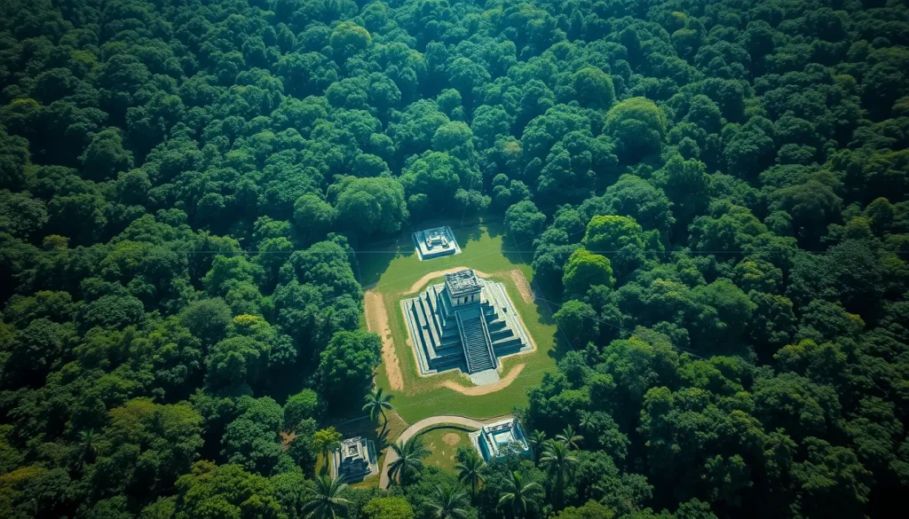
The dense jungles of Central America have long concealed the true scale of the ancient Maya civilization. For centuries, archaeologists relied on ground surveys and limited excavations, often hindered by thick vegetation and difficult terrain. However, a technological revolution known as Light Detection and Ranging, or LiDAR, is fundamentally altering this landscape. By firing laser pulses from aircraft that penetrate the forest canopy, researchers can now generate high-resolution digital elevation models of the ground beneath. This capability has led to the discovery of massive urban sprawls, intricate causeway systems, and defensive fortifications that were previously invisible to the naked eye. The integration of digital heritage tools with traditional archaeology is not merely finding new sites; it is upending established theories regarding Maya population density, agricultural capacity, and political organization.
Main Explanation
LiDAR technology operates by emitting hundreds of thousands of laser pulses per second from an aircraft flying in a grid pattern over a targeted region. These pulses travel through gaps in the vegetation until they strike the ground or structures, reflecting back to the sensor. By measuring the time it takes for each pulse to return, the system calculates precise distances, creating a point cloud of data. Specialized software then processes this data to digitally strip away the forest canopy, leaving behind a bare-earth model. This process reveals anthropogenic features such as pyramids, plazas, house mounds, and agricultural terraces that blend seamlessly into the jungle environment when viewed from the ground or via standard satellite imagery.
The implications of this technology are profound. Prior to widespread LiDAR adoption, Maya cities were often viewed as isolated ceremonial centers surrounded by sparse settlements. LiDAR surveys have demonstrated that these centers were actually part of vast, interconnected low-density urban complexes. The technology allows researchers to see the landscape as a modified environment, highlighting water management systems like reservoirs and dams, as well as defensive walls that suggest warfare was more prevalent than previously thought. Furthermore, LiDAR data aids in identifying astronomical alignments, such as E-Group assemblages, which indicate specific founding dates and cosmological orientations. This digital layer provides a comprehensive map that guides ground teams, allowing them to target excavations more efficiently and protect sites from looters by documenting them remotely.
Evidence & Sources
The empirical evidence supporting the transformative power of LiDAR in Maya archaeology is robust and rapidly accumulating. In the summer of 2016, a groundbreaking survey flew over approximately 2,100 square kilometres of the Maya Biosphere Reserve in the Petén region of northern Guatemala. When the data was processed at the University of Houston, researchers including Marcello Canuto and Francisco Estrada-Belli of Tulane University observed 61,000 ancient structures emerge from the bare-earth models. These structures ranged from isolated houses and large palaces to ceremonial centres and defensive walls. This single survey suggested a population density far higher than previous estimates, implying that the Maya lowlands supported millions of people during the Classic period.

Specific site discoveries further validate the technology’s efficacy. In October 2024, archaeologists revealed the lost city of Valeriana in the southeastern state of Campeche, Mexico. Named after a nearby freshwater lagoon, Valeriana was identified using laser mapping without the need for machetes to break through the jungle. The site features monumental precincts with enclosed plazas, temple pyramids, a ball court, and a reservoir formed by damming an arroyo. Crucially, the presence of a probable E-Group assemblage suggests a founding date prior to 150 AD, pushing back the timeline for urban development in the region. Similarly, in 2023, scientists used light-mapping technology to locate the monumental city of Ocomtun in Mexico’s central Yucatan Peninsula. These discoveries, published in journals such as Antiquity and reported by institutions like National Geographic, confirm that LiDAR is not just a theoretical tool but a practical instrument for discovery.
Another significant finding involves the site of Dzibanche in Mexico’s Yucatan. While an aerial view hardly hints at the true size of the location, LiDAR reveals that the Maya city sprawled more than seven square miles. This staggering scale underscores the sophistication of Maya urban planning. The consistency of these findings across different regions—from the Petén to Campeche—indicates a civilization that extensively modified its environment. The data also highlights agricultural terraces and causeways, providing evidence of how the Maya sustained large populations in a tropical environment. These digital records serve as permanent archives, preserving the spatial data of sites that might otherwise be degraded by climate change or human encroachment.
Deep Dive Analysis
Module F: Digital Archaeology
Technology Description: LiDAR (Light Detection and Ranging) is a remote sensing method that uses light in the form of a pulsed laser to measure ranges (variable distances) to the Earth. In the context of Maya archaeology, it is typically airborne, mounted on fixed-wing aircraft or helicopters.
How It Works: The system emits laser pulses at a rate of hundreds of thousands per second. These pulses penetrate vegetation gaps. The sensor records the return time and intensity of the reflection. Multiple returns per pulse allow the system to distinguish between the canopy, understory, and the ground surface.
Field Workflow: The process begins with planning a flight grid over the area of interest, such as the 2,100 square kilometres surveyed in the Petén region. Once the data is collected, it is transferred to processing centers, such as the University of Houston lab where Tulane researchers analyzed the 2016 data. Specialists filter the point cloud to classify ground points versus vegetation points.
Output/Data: The primary output is a Digital Elevation Model (DEM) or a Digital Terrain Model (DTM). These models visualize the bare earth, highlighting anomalies that indicate human construction. Researchers can generate hillshade models to enhance the visibility of subtle features like low mounds or causeways.
Example: The discovery of Valeriana in Campeche is a prime example. Researchers identified monumental structures, including pyramids and plazas, solely through laser mapping before ground verification. Similarly, the 61,000 structures mapped in Guatemala provided a statistical basis for recalculating regional population.
Strengths: The primary strength is the ability to see through dense jungle canopy, which is impossible with satellite imagery. It is non-invasive, reducing the need for destructive clearing. It covers large areas quickly, expediting the pace of archaeological discovery compared to traditional ground surveys.
Limitations: LiDAR cannot determine the chronology of a structure without ground excavation. It may miss features hidden under extremely thick vegetation where no laser pulses reach the ground. The technology is expensive, requiring aircraft and specialized processing software.
Accuracy: Modern LiDAR systems provide vertical accuracy within centimeters. This precision allows archaeologists to detect subtle architectural alignments, such as the E-Group assemblage at Valeriana which indicates a founding date prior to AD 150.
Cultural Heritage Considerations: While LiDAR protects sites by reducing the need for physical clearing, the publication of precise locations can potentially attract looters. Researchers like those at Tulane University must balance open science with site security. Additionally, the data belongs to the heritage of the modern descendant communities, requiring ethical collaboration and data sharing agreements.
FAQ
How does LiDAR see through the jungle?
LiDAR fires laser pulses from an aircraft that pass through gaps in the vegetation canopy. Some pulses hit leaves, but others reach the ground and reflect back, allowing computers to digitally remove the trees.
How many structures have been found using LiDAR?
In a major 2016 survey of the Maya Biosphere Reserve alone, LiDAR revealed over 61,000 ancient structures, including houses, palaces, and ceremonial centers.
Does LiDAR replace archaeological excavation?
No, LiDAR identifies potential sites and maps layouts, but ground excavation is still required to determine dates, retrieve artifacts, and understand the human history of the structures.

Leave a Reply