
Short Answer
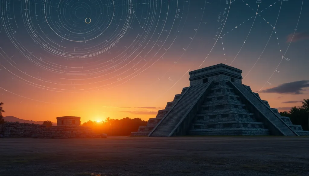
The study of ancient Maya astronomy has undergone a significant transformation with the advent of specialized digital software tools. Historically, archaeoastronomers relied on manual calculations and static star charts to verify alignments at sites like Chichén Itzá or Izapa. Today, researchers utilize sophisticated computational engines that render local horizons and sky tracks for terrestrial observers with sufficient precision for historical times. These tools leverage open-source software frameworks and geographical data to bridge the gap between ancient cultural descriptions and modern celestial mechanics. By simulating the sky as it appeared centuries ago, scholars can test hypotheses regarding architectural alignments, calendar cycles, and cosmological beliefs without the ambiguity of modern atmospheric interference.
Main Explanation
The core function of archaeoastronomy software is to calculate the positions of celestial objects—such as the sun, moon, planets, and stars—relative to a specific geographic location and historical date. This process requires accounting for astronomical phenomena that change over long periods, including precession, nutation, and proper motion. Modern tools integrate high-precision ephemerides, such as the DE421 model used by NASA, to ensure accuracy. Unlike general-purpose planetarium software, specialized cultural astronomy tools are designed to handle the specific needs of historical research. They often incorporate features to render the local horizon profile, which is critical for determining visibility conditions at ancient sites where mountains or structures might obscure the sky.
Furthermore, these applications facilitate the conversion of cultural sky descriptions into precise coordinates. For instance, ancient texts may describe a planetary position using mythological imagery rather than degrees of arc. Advanced engines now exist to translate these cultural narratives, such as Mayan or Babylonian descriptions, into standard J2000 coordinates. This capability allows for a direct comparison between historical records and computed astronomical data. The shift towards open-source platforms, particularly those built on Python, has democratized access to these tools. Researchers can now deploy Dockerized microservices or command-line libraries to run complex simulations without requiring proprietary licenses. This openness fosters collaboration and reproducibility, essential components of scientific inquiry in digital heritage.
Evidence & Sources
Several specific software projects highlight the current state of the field. One notable initiative is the development of tools aimed at obtaining cultural astronomy software through open-source means. Research published in Mediterranean Archaeology and Archaeometry introduced tools that render local horizons and sky tracks using geographical data. This work emphasizes the importance of precision for historical times and establishes a foundation for further software development in the field. Another significant contribution is the MontuPython library, which provides astronomical ephemerides specifically designed for the ancient world. This Python package allows researchers to calculate planetary positions across vast historical timelines, supporting languages and frameworks common in modern data science.
In addition to libraries, integrated engines like the Sky Culture MCP serve as archaeoastronomy computation engines. This tool functions as a “Many-to-One” engine, converting diverse cultural sky descriptions into standardized NASA-grade coordinates. It is powered by Python and Skyfield, ensuring that the underlying mechanical models are robust. Furthermore, institutional labs have developed virtual simulators for specific sites. The IDIA Lab at Ball State University, for example, created a Virtual Solar Simulator applied to the Izapa Group F Ballcourt. This simulator polls data from the NASA JPL Horizons database and accounts for the Chandler Wobble, a periodic deviation in the Earth’s rotation. Such tools provide visual verification of alignments, such as the winter solstice sunrise at Izapa, which is often off-axis by approximately two degrees in direct observation today.
Deep Dive Analysis
Module F: Digital Archaeology
Technology Description
The software tools used for simulating ancient Maya astronomy events fall under the umbrella of digital archaeology and computational archaeoastronomy. These technologies combine celestial mechanics algorithms with geographic information systems (GIS). The primary technology stack often involves Python, utilizing libraries such as Skyfield for high-precision astronomical calculations. Some tools are packaged as Docker containers, allowing them to run as microservices within larger digital heritage frameworks. This modular approach ensures that the simulation engine can be updated independently of the user interface or data visualization components.
How It Works
The workflow typically begins with the input of geographic coordinates (latitude, longitude, and elevation) for the archaeological site. The user then specifies a historical date, often correlated with a Maya Calendar Round or Long Count date. The software queries an ephemeris database, such as DE421, to retrieve the positions of celestial bodies. It then calculates the local horizon profile, either from user-input data or digital elevation models. Finally, the system renders the sky track, showing the path of celestial objects relative to the horizon and any architectural features. Advanced tools may also convert cultural descriptions into these coordinates, allowing for a reverse-engineering of ancient observations.
Field Workflow
In a research context, the workflow involves validating site alignments against simulated data. A researcher might measure the azimuth of a temple doorway using a total station in the field. This data is then input into the simulation software to determine which celestial event, if any, aligns with the structure on a specific date. For example, verifying if a structure aligns with the Venus extreme north rising point requires precise simulation of Venus’s cycle over centuries. The software allows for rapid iteration, testing multiple dates and celestial bodies without the need for physical presence at the site during specific astronomical events.
Output and Data
The output of these simulations includes visualization scripts, coordinate data, and horizon renders. Visualizations may take the form of 2D plots showing altitude versus azimuth or 3D reconstructions of the site with the sky overlay. Data outputs often include CSV or JSON files containing the precise right ascension and declination of objects at specific times. This data can be archived and shared, contributing to a growing repository of archaeoastronomical evidence. The ability to export NASA-grade coordinates ensures that findings can be peer-reviewed and replicated by other institutions.
Example: Izapa Group F Ballcourt
A prominent example of this technology in action is the simulation of the Izapa Group F Ballcourt in Chiapas, Mexico. Izapa is considered a key site in the development of the Maya Long Count calendar. Using a Virtual Solar Simulator, researchers analyzed the alignment of the ballcourt axis from throne #2 to stela #60. The simulation revealed that while the site is generally aligned to the winter solstice sunrise, it is off-axis by approximately two degrees in direct observation today. The software accounts for factors like the Chandler Wobble, providing a more nuanced understanding than simple compass measurements. This helps distinguish between precise astronomical intent and general orientational trends.
Strengths
The primary strength of these tools is precision. They account for complex gravitational interactions and Earth rotation variations that manual calculations cannot easily handle. They also offer reproducibility; a simulation run today will yield the same results tomorrow, provided the input parameters remain constant. Additionally, the use of open-source tools lowers the barrier to entry, allowing researchers in countries with limited funding, such as Honduras, to participate in high-level archaeoastronomical research. The integration of cultural descriptions into coordinate systems also bridges the gap between humanities and hard sciences.
Limitations
Despite their power, these tools have limitations. The accuracy of the simulation depends heavily on the quality of the input data, particularly the local horizon profile. If the ancient horizon differed significantly from the modern terrain due to vegetation or construction, the simulation may be skewed. Furthermore, atmospheric refraction models are often standardized and may not account for local weather conditions at the time of observation. There is also the risk of over-interpreting data; a close alignment in a simulation does not definitively prove intentional design without corroborating archaeological evidence. Finally, some tools require technical proficiency in programming languages like Python, which may exclude traditional archaeologists without computational training.
Accuracy
When powered by JPL Horizons data and modern ephemerides like DE421, the celestial mechanics are accurate to within arcseconds for historical dates. However, the archaeological accuracy depends on the precision of the site survey. Tools that account for the Chandler Wobble provide a higher fidelity representation of Earth’s orientation than those that do not. Researchers must remain aware that while the sky simulation is mathematically precise, the interpretation of its cultural significance remains a subject of scholarly debate.
Cultural Heritage Considerations
The use of digital tools in Maya astronomy research must be conducted with respect for descendant communities. Simulations that touch upon calendar cycles, such as the end of the 13th Baktun in 2012, should be framed scientifically rather than sensationally. Digital heritage specialists must ensure that these tools serve to illuminate ancient knowledge systems without appropriating them for modern spiritual claims. Open licensing, such as MIT or Creative Commons, encourages collaboration but requires proper attribution to the originating institutions and researchers.
FAQ
What software is best for simulating Maya astronomy?
Tools like MontuPython, Sky Culture MCP, and the IDIA Lab Virtual Solar Simulator are leading options, utilizing Python and NASA-grade ephemerides.
How accurate are these simulations for ancient dates?
They are highly accurate for celestial mechanics using DE421 ephemerides, though local horizon data and atmospheric conditions introduce some variables.
Can these tools verify calendar alignments?
Yes, they can calculate celestial positions for specific Long Count dates to verify architectural alignments like solstice sunrises at sites such as Izapa.



Leave a Reply