
Short Answer
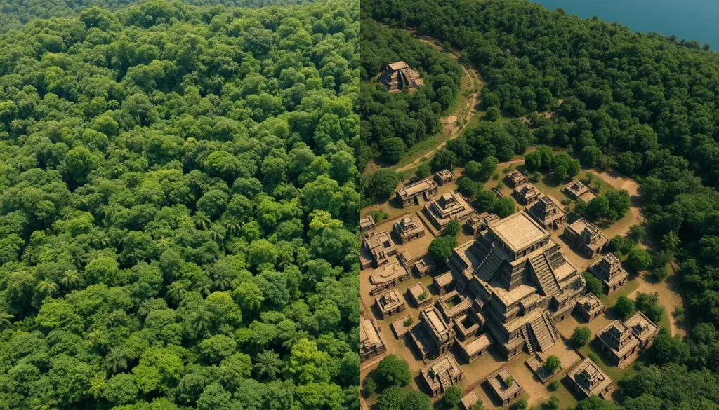
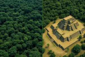
For over a century, the study of the ancient Maya civilization was defined by the physical struggle against the environment. Archaeologists endured grueling heat, humidity, and encounters with deadly wildlife to map ruins that were often just the tip of the iceberg. The dense forest canopy of Central America concealed the true scale of Maya urbanization, leading to significant underestimates of population density and political complexity. However, the advent of Light Detection and Ranging (LiDAR) technology has fundamentally upended these long-held assumptions. By digitally stripping away the vegetation, LiDAR has revealed a staggering landscape of interconnected cities, causeways, and defensive fortifications that were previously invisible to the naked eye.
Main Explanation
LiDAR represents a paradigm shift in Mesoamerican archaeology, transitioning the field from a labor-intensive, ground-based discipline to one that incorporates high-resolution aerial surveying. The technology functions by emitting laser pulses from an aircraft toward the ground. These pulses penetrate gaps in the forest canopy and reflect off the earth’s surface and any structures beneath it. By measuring the time it takes for the laser to return, sensors create a precise three-dimensional point cloud of the terrain. Specialized algorithms then filter out returns from vegetation and buildings, generating a Digital Elevation Model (DEM) of the bare earth.
The implications of this technology are profound. Prior to widespread LiDAR adoption, archaeologists relied on ground surveys and limited aerial photography, which often missed structures obscured by thick jungle growth. The new data suggests that the Maya lowlands were home to millions more people than previously estimated. The landscape is not merely a scattering of independent city-states but a highly integrated urban network. Features such as elevated highways, known as causeways, link major centers like Tikal to outlying settlements, indicating sophisticated political control and economic integration. Furthermore, the discovery of extensive defensive fortifications suggests that warfare played a more central role in Maya geopolitics than the classical view of a peaceful, theocratic society allowed.
Evidence & Sources
The empirical evidence supporting this archaeological revolution is robust and continues to grow. A groundbreaking project published in Science and highlighted by Brown University surveyed 2,100 square kilometers of the Guatemalan forest. This single survey revealed more than 60,000 hidden Maya ruins, including houses, palaces, and defensive works. Stephen Houston, a professor of archaeology and anthropology at Brown University, described the magnitude of the survey as “breathtaking,” noting it as one of the greatest advances in over 150 years of Maya archaeology.

Recent findings continue to validate the technology’s efficacy. In 2024, National Geographic reported on how LiDAR revealed that the Maya city of Dzibanche in Mexico’s Yucatan sprawled more than seven square miles, a scale hardly hinted at by aerial views alone. Additionally, a study published in the journal Antiquity detailed the discovery of Valeriana, a lost Mayan city in the southeastern state of Campeche, Mexico. Named after a nearby freshwater lagoon, Valeriana features monumental precincts with enclosed plazas, temple pyramids, and a ball court. Crucially, the site includes a probable E-Group assemblage, an architectural arrangement indicating a founding date prior to AD 150. These discoveries were made without the need to break through the jungle with machetes, demonstrating the non-invasive power of digital mapping.
“I think this is one of the greatest advances in over 150 years of Maya archaeology.” — Stephen Houston, Professor of Archaeology and Anthropology at Brown University
Deep Dive Analysis
Module F: Digital Archaeology
Technology Description
LiDAR (Light Detection and Ranging) is a remote sensing method that uses light in the form of a pulsed laser to measure ranges (variable distances) to the Earth. In the context of Maya archaeology, it is specifically Airborne Laser Scanning (ALS) that is utilized to map large, inaccessible areas.
How it Works
The system typically consists of a laser scanner, a GPS receiver, and an Inertial Measurement Unit (IMU) mounted on an aircraft. The laser scanner emits hundreds of thousands of pulses per second. When these pulses hit the ground or structures, they reflect back to the sensor. The GPS and IMU record the precise position and orientation of the aircraft at the moment of each pulse. This data allows for the calculation of the exact three-dimensional coordinates (X, Y, Z) of every reflection point.
Field Workflow
The workflow begins with mission planning to determine flight altitude and line spacing, ensuring sufficient point density (often 10 to 20 points per square meter for archaeological purposes). Once the data is collected, it undergoes processing to classify points into categories such as ground, vegetation, and buildings. Archaeologists then analyze the resulting bare-earth models to identify anthropogenic features.
Output/Data
The primary output is a high-resolution Digital Elevation Model (DEM) or Digital Terrain Model (DTM). These models can be visualized using hillshade relief, which simulates sunlight hitting the terrain from various angles to accentuate subtle topographic changes. This visualization technique makes even low earthen mounds, which might be house foundations, clearly visible.
Example
The 2016 survey in northern Peten, Guatemala, is the quintessential example. It mapped over 810 square miles and revealed a sprawling network connecting the city of Tikal to other sites. More recently, the 2024 discovery of Valeriana in Campeche demonstrated the technology’s ability to identify specific architectural styles, such as E-Groups, which help date the foundation of cities without excavation.
Strengths
The primary strength of LiDAR is its ability to cover vast areas quickly and penetrate dense vegetation that obscures ground surveys. It provides a comprehensive regional perspective rather than a site-specific one, allowing researchers to understand settlement patterns and infrastructure on a civilizational scale.
Limitations
Despite its power, LiDAR is not a replacement for excavation. It identifies anomalies but cannot determine the function, date, or cultural affiliation of a structure without ground-truthing. Additionally, the technology is expensive, requiring specialized aircraft and processing software, which can limit its use in underfunded regions.
Accuracy
Modern archaeological LiDAR achieves vertical accuracy within 10 to 20 centimeters. This precision is sufficient to distinguish between natural hills and constructed pyramids or platforms, which often have distinct geometric profiles.
Cultural Heritage Considerations
The publication of LiDAR data carries risks. While it aids preservation, detailed maps of unexcavated sites can inadvertently guide looters to untouched treasures. Researchers must balance open scientific data with the protection of vulnerable heritage sites from illegal trafficking and destruction.
FAQ
How does LiDAR see through the jungle?
LiDAR uses laser pulses that can pass through small gaps in the forest canopy. Some pulses hit leaves, but many reach the ground. By filtering out the returns from vegetation, archaeologists can create a map of the ground surface beneath the trees.
Did the Maya build the cities found by LiDAR?
Yes. The structures revealed, such as pyramids, ball courts, and causeways, exhibit distinct Maya architectural styles. Ground verification by archaeologists confirms these are anthropogenic features built by the Maya civilization.
Does LiDAR replace excavation?
No. LiDAR identifies potential sites and features from the air, but excavation is still required to determine the date, function, and cultural context of the structures. It guides where archaeologists should dig.
What is the city of Valeriana?
Valeriana is a lost Mayan city discovered in Campeche, Mexico, using laser mapping. It features monumental precincts, plazas, and a reservoir, and is believed to have been founded before AD 150.


Leave a Reply