
Short Answer
The intersection of archaeology and digital heritage has revolutionized the study of ancient skies, particularly within Mesoamerican contexts. Simulating the Ancient Sky involves using sophisticated software to reconstruct the positions of celestial bodies as they appeared from specific archaeological sites at moments in antiquity. This process allows researchers to test hypotheses regarding architectural alignments, such as solstice sunrises at Stonehenge or the Pleiades rising over Chaco Canyon, and applies equally to the complex cosmological landscape of the Maya civilization. Powered by engines like Stellarium Web, these tools provide a scientific basis for understanding how ancient cultures perceived and integrated celestial phenomena into their built environment and calendar systems.
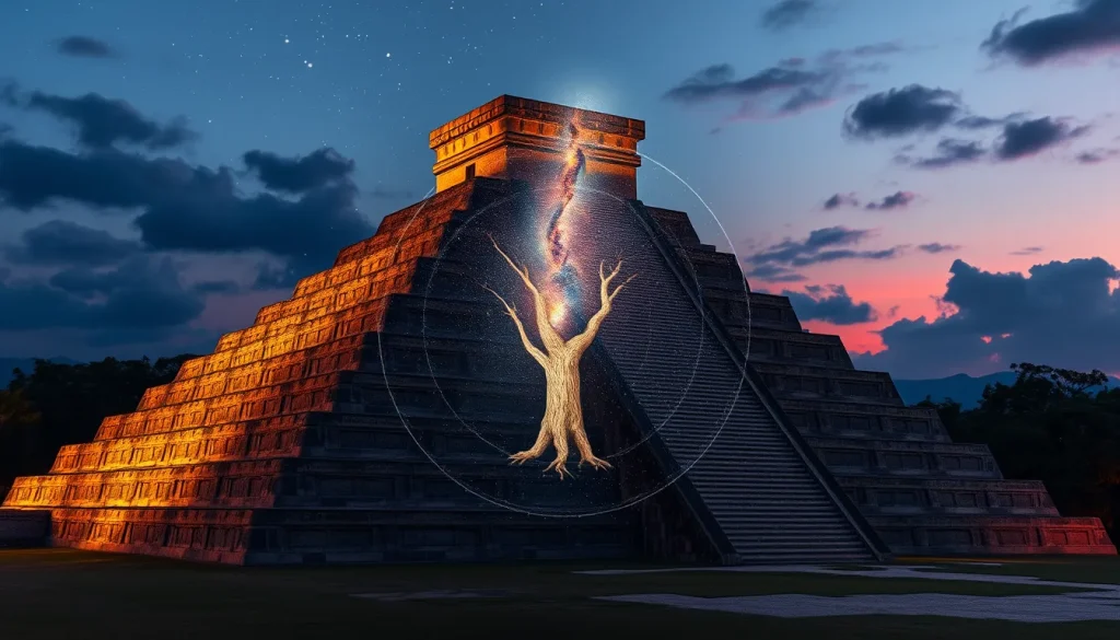
For the Maya, the sky was not merely a backdrop but an active component of cosmology and timekeeping. Digital simulations enable the visualization of critical moments, such as the Maya creation date of August 13, 3114 BCE, where the Milky Way stood vertical as the World Tree at dawn. By combining accurate ephemerides with geographical data, scholars can render the local horizon and sky tracks of celestial objects with sufficient precision for historical times. This capability moves the field beyond speculative analogies, offering testable models of ancient observation practices.
Main Explanation
Digital sky simulation for archaeoastronomy relies on the integration of astronomical algorithms, geographical information systems (GIS), and 3D modeling. The core technology involves desktop planetarium programs that have evolved to handle deep-time calculations. Unlike popular consumer astronomy apps, research-grade software accounts for precession, proper motion of stars, and changes in the Earth’s obliquity over millennia. This ensures that the sky rendered for a date like 562 BCE accurately reflects the position of Venus or the Sun relative to the horizon at that specific epoch.
The workflow typically begins with the precise geolocation of an archaeological site. Latitude, longitude, and elevation are input into the software to establish the observer’s frame of reference. Subsequently, the local horizon is modeled. In early applications, this was a simple flat horizon, but modern tools allow for the importation of digital elevation models (DEMs) to account for mountain ranges and valleys that would have obstructed or framed celestial events for ancient observers. For Maya sites nestled in the jungle or atop pyramids, the specific topography is crucial for determining visibility.
Furthermore, these simulations incorporate temporal evolution. The software can animate the sky over centuries, allowing researchers to identify long-term cycles such as the 584-day Venus cycle or the 18-year eclipse cycle. This dynamic capability is essential for understanding the Maya Dresden Codex Venus tables, which tracked the morning and evening star phases over long periods. By simulating these cycles against the backdrop of specific temple orientations, archaeologists can determine if a structure was deliberately aligned to capture a specific celestial event, such as the maximum elongation of Venus as a morning star.
Evidence & Sources
The academic foundation for these digital tools is rooted in recent publications within the fields of cultural astronomy and virtual archaeology. Research published in the Journal of Skyscape Archaeology highlights the transition from analogue tools like paper planispheres to immersive sky simulators. Authors such as Georg Zotti and Susanne M. Hoffmann have documented how open-source software tools have gained wide attention for their ability to model the rich nocturnal environment of the starry sky with high fidelity. Their work emphasizes that while optomechanical planetariums provided early immersive experiences, their high construction costs limited common use, whereas desktop programs offer accessible alternatives for research.
Specific developments in software architecture are detailed in studies regarding Cultural Astronomy Software. For instance, work by Eduardo Rodas-Quito and Javier Mejuto introduced tools designed to render the local horizon for a terrestrial observer and the sky tracks of celestial objects. These tools utilize open-source software and geographical data to achieve precision sufficient for historical times. This open-source approach is vital for the archaeological community, allowing for peer review and modification of the code to suit specific regional needs, such as the dense canopy considerations of the Maya lowlands.
Moreover, the integration of 3D models into sky simulations represents a significant advancement. Publications from the Ludwig Boltzmann Institute for Archaeological Prospection and Virtual Archaeology describe plugins introduced for Stellarium to visualize loadable scenes of 3D reconstructions of past or present monuments in their landscape. This means researchers can place a digital reconstruction of a Maya temple, such as El Caracol at Chichén Itzá, within the simulation to view the sky exactly as an ancient priest standing on the summit would have seen it. This fusion of architectural reconstruction and astronomical simulation provides a robust evidentiary basis for claims regarding intentional alignment.
Deep Dive Analysis
Module F: Digital Archaeology
Technology Description
The primary technology utilized in simulating the ancient sky for Maya archaeoastronomy is the open-source desktop planetarium software, Stellarium, enhanced with specialized plugins for archaeological research. This software serves as a digital engine capable of calculating celestial positions across several millennia. It is complemented by Geographic Information Systems (GIS) for terrain modeling and Computer-Aided Design (CAD) software for reconstructing architectural elements.
How It Works
The system operates by processing astronomical ephemerides, which are tables of values that give the positions of naturally occurring astronomical objects as well as artificial satellites in the sky at a given time or times. The software applies corrections for precession of the equinoxes and nutation. When combined with a digital terrain model, the software calculates the altitude and azimuth of celestial bodies relative to the specific horizon profile of the archaeological site. The 3D plugin allows users to load architectural models into the scene, occluding the sky where structures would have blocked the view.
Field Workflow
The workflow begins with site surveying using total stations or GPS to capture precise coordinates and elevation data. Researchers then compile historical and archaeological data to reconstruct the site’s appearance during the period of interest, accounting for vegetation growth or erosion. This data is converted into a format compatible with the simulation software. Finally, specific dates of cultural significance, such as solstices or calendar round endings, are selected for simulation.
Output/Data
The output consists of visual renderings, video animations, and quantitative data sets regarding azimuth and altitude angles. For example, a simulation might produce a visualization of the sunrise on the Summer Solstice, June 21, showing the solar standstill at maximum northern declination. Data logs can confirm whether the sun rises directly over a specific temple peak within a margin of error of less than one degree.
Example
A prominent example involves the Maya Creation Date. Simulations reconstruct the sky of August 13, 3114 BCE, demonstrating that the Milky Way stood vertical as the World Tree at dawn. Another example is the alignment of the Giza pyramids during the Old Kingdom when Thuban served as the pole star, a methodology similarly applied to Maya sites to check for pole star alignments during the Classic Period. Additionally, Venus simulations can replicate the conditions of April 17, 562 BCE, marking a maximum greatest elongation of Venus as a morning star, critical for interpreting the Maya Dresden Codex Venus tables.
Strengths
The primary strength of digital simulation is accessibility and repeatability. Unlike physical planetariums, these tools can be run on standard personal computers, allowing widespread collaboration. They offer high precision for historical applications, simulating motions over several millennia. The ability to toggle layers, such as removing modern light pollution or vegetation, provides a clearer view of ancient sightlines.
Limitations
Limitations include the accuracy of the underlying terrain data and the reconstruction of ancient vegetation. A digital model may not account for a tree that grew and died over centuries, which could have blocked a sightline. Furthermore, atmospheric conditions such as haze or cloud cover are difficult to model historically, though some software attempts to simulate atmospheric extinction.
Accuracy
Recent versions of these tools have been improved to become accurate enough for archaeoastronomical applications. The simulation of celestial object positions is generally reliable within arcminutes for historical times. However, the accuracy of the horizon model depends on the quality of the archaeological reconstruction. Uncertainty remains regarding the exact height of structures that may have been modified or destroyed.
Cultural Heritage Considerations
It is crucial to distinguish between historical Maya beliefs and modern interpretations. Digital tools should be used to test archaeological evidence, such as architectural alignments, rather than to validate New Age spiritual claims. Researchers must avoid fabricating connections between celestial events and modern esoteric beliefs. The focus remains on how the ancient Maya utilized these observations for agriculture, ritual, and politics, grounded in textual evidence like the Dresden Codex and physical evidence like temple orientations.
FAQ
How accurate are digital sky simulations for ancient dates?
Modern software like Stellarium simulates celestial motions over several millennia with sufficient accuracy for most historical applications, accounting for precession and proper motion.
Can these tools prove Maya temples were aligned to stars?
They provide strong evidence by visualizing alignments, but archaeological context and textual evidence are required to confirm intentional design versus coincidence.
What is the significance of August 13, 3114 BCE?
This is the Maya Long Count Zero date (0.0.0.0.0), where simulations show the Milky Way stood vertical as the World Tree at dawn.



Leave a Reply