
Short Answer
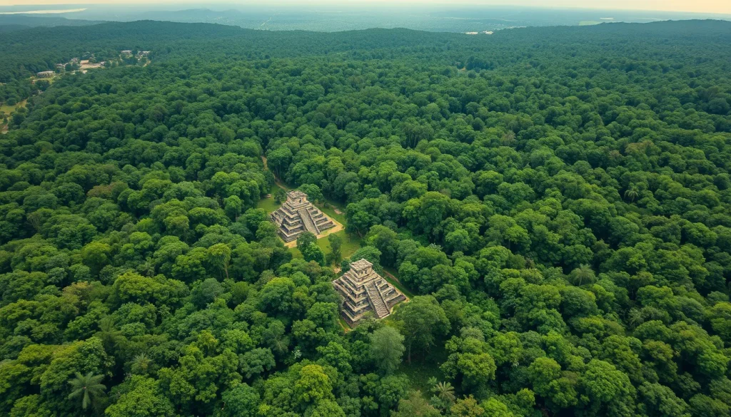
The application of Light Detection and Ranging (LiDAR) technology has fundamentally transformed the study of ancient Mesoamerican landscapes and settlement patterns. For decades, archaeologists struggled to survey the dense tropical forests of the Maya lowlands, where vegetation obscured architectural features and infrastructure. LiDAR has permitted the recovery of ground data from huge regional areas that are currently under a tropical canopy, providing detailed datasets that traditional methods of survey and mapping could never have achieved. This technological advancement represents a conjunctive task involving archaeologists, physicists, and computer scientists, producing new results and interpretations while raising issues regarding data storage and distribution that require resolution.
Main Explanation
LiDAR is a remote sensing method that uses light in the form of a pulsed laser to measure ranges (variable distances) to the Earth. In the context of Maya archaeology, airborne LiDAR systems are mounted on aircraft to scan large swaths of the jungle floor. The system emits laser pulses that penetrate gaps in the vegetation canopy, reflecting off the ground surface and returning to the sensor. By measuring the time it takes for the light to return, the system calculates precise distances, generating a high-resolution three-dimensional representation of the terrain known as a Digital Elevation Model (DEM). This process effectively strips away the forest cover digitally, revealing anthropogenic features such as pyramids, plazas, causeways, and agricultural terraces that remain invisible to the naked eye from the ground or via standard satellite imagery.
The significance of this technology lies in its ability to contextualize individual sites within their broader landscape. Prior to LiDAR, settlement surveys were labor-intensive and limited to small transects, often leading to underestimations of population density and societal complexity. LiDAR allows for the synoptic view of entire regions, enabling researchers to understand how ancient Maya cities interacted with their environment and each other. The analyses of LiDAR data are interdisciplinary, producing new interpretations for all fields involved. Furthermore, future collection of LiDAR data will benefit Mesoamerica through helping to preserve a landscape of the past, creating a digital archive of sites that may be threatened by modern development or environmental degradation.
Evidence & Sources
The efficacy of LiDAR in Maya archaeology is well-documented through peer-reviewed research and case studies spanning over a decade. A seminal case study conducted at Caracol, Belize, demonstrated the power of airborne LiDAR to map an ancient Maya landscape in unprecedented detail. Research published by Chase et al. in 2011 highlighted that advances in remote sensing and space-based imaging had increased understanding of past settlements, but images in tropical regions lacked the detail necessary for computational analysis until the introduction of LiDAR. The Caracol project revealed that the site was far larger and more integrated than previously thought, with extensive causeway systems and residential groups mapped across the landscape.

Subsequent research has focused on refining the accuracy of these digital maps. A 2023 review by Garrison and colleagues assessed the LiDAR revolution in the Maya lowlands, noting that while most investigations have an archaeological focus, there is a lack of consistency in assessing the accuracy of archaeological feature classifications. Variables such as sensor type, class definitions, and ground-truthing methods differentially affect assessment results across the Lowlands. The review concluded that area-based ground-truthing approaches to classifications of full waveform LiDAR data present the most comprehensive accuracy assessments. Additionally, Thompson (2020) explored detecting Classic Maya settlements with LiDAR-derived relief visualizations, demonstrating how specific visualization techniques enhance the identification of settlement patterns. These sources collectively establish LiDAR not just as a mapping tool, but as a critical component of modern settlement archaeology and landscape archaeology in the tropics.
Deep Dive Analysis
Technology Description
LiDAR (Light Detection and Ranging) is an active remote sensing system that uses laser light to measure distance. In archaeological applications, it is typically airborne, mounted on planes or helicopters, allowing for the coverage of large, inaccessible areas. The technology relies on the time-of-flight principle, where the sensor measures the time interval between the emission of a laser pulse and the detection of the reflected signal.
How It Works
The system emits hundreds of thousands of laser pulses per second. In a forested environment like the Maya lowlands, many pulses are intercepted by leaves and branches, creating a “first return.” However, a portion of the pulses penetrates the canopy gaps and hits the ground, creating a “last return.” By filtering out the non-ground returns, specialists can generate a bare-earth model. This process requires sophisticated algorithms to distinguish between vegetation noise and actual archaeological features.
Field Workflow
The workflow begins with flight planning to ensure adequate overlap and coverage. Once data is collected, it undergoes processing to classify points into categories such as ground, vegetation, and buildings. Archaeologists then work with computer scientists to analyze the resulting digital terrain models. This interdisciplinary effort is essential, as raw data alone does not yield archaeological interpretation without expert analysis.
Output/Data
The primary output is a high-resolution Digital Elevation Model (DEM) or Digital Terrain Model (DTM). These models can be visualized using various relief visualization techniques, such as hillshading or sky-view factor, to enhance the visibility of subtle earthworks. The data allows for the computation of settlement densities and infrastructure networks that were previously unknown.
Example
The Caracol, Belize project serves as the primary example. LiDAR mapping revealed that Caracol was a massive urban center with a population and infrastructure scale that traditional surveying had missed. The data showed extensive agricultural terracing and causeway systems connecting the city to its hinterland, transforming the understanding of Maya political economy.
Strengths
The primary strength of LiDAR is its ability to penetrate tropical canopy, which has historically been the biggest barrier to archaeological survey in Mesoamerica. It provides detailed data over huge regional areas quickly and non-invasively. It transforms the way in which Mesoamerican settlement survey is done, allowing for regional analysis rather than site-centric studies.
Limitations
Despite its advantages, LiDAR raises issues that need resolution, particularly involving data storage and distribution. The sheer volume of data generated requires significant computational resources. Additionally, there are challenges in data accessibility for local researchers and institutions in source countries.
Accuracy
Accuracy varies based on sensor type and processing methods. A geographic approach to understanding feature classification accuracy indicates that there is a lack of consistency in assessing the accuracy of archaeological feature classifications in LiDAR data. Ground-truthing remains essential to validate digital interpretations, as not all anomalies represent human construction.
Cultural Heritage Considerations
LiDAR helps preserve a landscape of the past by creating a permanent digital record. However, the distribution of this data must be managed carefully to prevent looting. The technology supports heritage management by identifying sites that need protection from modern agricultural expansion or urban development.
FAQ
Why is LiDAR necessary for Maya archaeology?
Traditional survey methods cannot penetrate the dense tropical canopy of the Maya lowlands. LiDAR uses laser pulses to map the ground surface beneath the vegetation, revealing structures invisible from the ground or air.
Does LiDAR data replace excavation?
No. LiDAR identifies features and settlement patterns, but ground-truthing and excavation are still required to determine dates, function, and cultural context of the identified structures.
What are the main limitations of LiDAR in this region?
Challenges include data storage and distribution, consistency in feature classification accuracy, and the need for interdisciplinary collaboration to interpret the complex datasets correctly.


Leave a Reply