
Short Answer
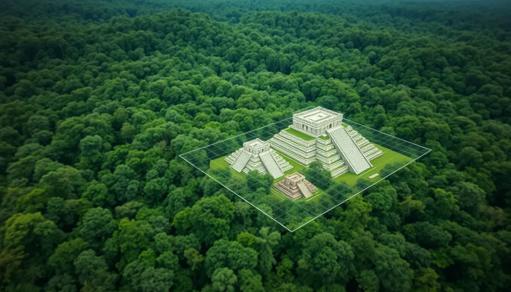
For centuries, the dense tropical forests of Central America concealed the true extent of the ancient Maya civilization. Traditional archaeological methods, reliant on ground surveys and excavation, were hindered by grueling heat, humidity, and inaccessible terrain. However, a technological revolution has recently upended everything researchers thought they knew about the Maya world. Light Detection and Ranging, commonly known as LiDAR, has emerged as a transformative tool in digital heritage and archaeology. By employing laser technology to digitally remove the forest canopy, LiDAR allows scientists to map the ground surface beneath the jungle with unprecedented precision. This capability has revealed staggering scales of urbanization, infrastructure, and sophistication that were previously invisible to the naked eye.
Main Explanation
LiDAR technology functions by emitting rapid pulses of laser light from an airborne platform, typically an airplane, toward the ground. These pulses penetrate gaps in the vegetation canopy and reflect off the ground surface and any structures present. By measuring the time it takes for the light to return to the sensor, the system calculates precise distances, generating a detailed three-dimensional model of the topography. In the context of Maya archaeology, this process effectively strips away the jungle digitally, exposing ruins, causeways, and agricultural terraces that have been shrouded for centuries. The resolution of modern airborne LiDAR is fine enough to resolve ground features as minute as one meter, allowing researchers to identify individual structures without disturbing the soil.
The implementation of this technology has shifted the paradigm of Maya studies from viewing isolated city-states to understanding a vast, interconnected urban settlement. Prior to these surveys, the Maya lowlands were often perceived as sparsely populated regions centered around major ceremonial hubs. LiDAR data has contradicted this view, demonstrating that the landscape was heavily modified and densely inhabited. The technology enables archaeologists to survey large areas quickly, covering thousands of square kilometers that would take decades to map using traditional pedestrian survey methods. This efficiency is crucial in regions where illegal looting and natural degradation threaten archaeological sites.
Evidence & Sources
The empirical evidence supporting the impact of LiDAR on Maya archaeology is substantial and documented in peer-reviewed scientific literature. A groundbreaking project undertaken in 2016, led by researchers including Stephen Houston of Brown University, surveyed 2,100 square kilometers of Guatemalan forest. The results, published in the journal Science, revealed new information about the Maya’s interconnected urban settlement and extensive infrastructure. This project, funded by the PACUNAM foundation, mapped more than 61,000 structures in the Maya lowlands, including houses, palaces, and elevated causeways. The data indicated that the Maya population was significantly larger than previously estimated, requiring sophisticated agricultural systems to sustain such density.

Further discoveries continue to emerge as technology improves and surveys expand. In October 2024, archaeologists revealed a lost Mayan city named Valeriana in the southeastern state of Campeche, Mexico. Identified through laser mapping, the city is believed to have been founded before 150 AD. The site features monumental structures such as pyramids, plazas, and a ball court, indicating it served as a classic Mayan political capital. Similarly, research published in February 2024 by National Geographic Explorers from Tulane University focused on the site of Dzibanche in Mexico’s Yucatan. LiDAR revealed that this city sprawled more than seven square miles, a size hardly hinted at by aerial views alone. These findings collectively rewrite the understanding of the scale and complexity of the Maya civilization, which flourished for thousands of years before vanishing beneath the dense forest.
Deep Dive Analysis
Technology Description
LiDAR (Light Detection and Ranging) is a remote sensing method used to examine the surface of the Earth. In archaeological applications, it is specifically referred to as airborne laser scanning (ALS). The system comprises a laser scanner, a GPS receiver, and an inertial measurement unit (IMU) mounted on an aircraft. The laser scanner emits hundreds of thousands of pulses per second. When these pulses hit objects such as tree leaves or building stones, they reflect back to the sensor. The system records multiple returns for each pulse, allowing researchers to distinguish between the canopy top and the ground surface.
How It Works
The core mechanism relies on time-of-flight calculations. The sensor measures the time interval between the emission of the laser pulse and the detection of the reflected signal. Since the speed of light is constant, this time interval translates directly into distance. By combining this distance data with the precise position and orientation of the aircraft provided by GPS and IMU, a point cloud is generated. This point cloud consists of millions of coordinate points (x, y, z) that represent the surfaces hit by the laser. Algorithms are then used to classify these points, separating vegetation from ground features. The ground points are interpolated to create a Digital Elevation Model (DEM), which visualizes the bare earth topology.
Field Workflow
The workflow begins with mission planning, where flight paths are designed to ensure complete coverage of the target area with sufficient overlap. The aircraft flies over the region, often at altitudes optimized for the desired ground resolution. Once the data is collected, it undergoes extensive processing. This includes trajectory calculation, point cloud generation, and classification. Archaeologists then analyze the resulting digital terrain models, looking for geometric anomalies that indicate human construction, such as straight lines, right angles, or elevated platforms. Ground truthing follows, where teams visit specific coordinates identified in the data to verify the findings through excavation or surface inspection.
Output/Data
The primary output is a high-resolution 3D map of the terrain. These maps can be rendered as hillshades, slope maps, or sky-view factors to enhance the visibility of subtle features. In the Maya lowlands, these outputs have revealed causeways (sacbeob), reservoirs, and defensive fortifications. For example, finely scaled topography stands out in lidar-generated maps of Maya settlements north of the ancient city of Tikal. The data allows for the quantification of structures, enabling statistical analysis of settlement patterns and urban density.
Example
A prominent example is the mapping of the region north of Tikal in present-day Guatemala. The lidar measurements showed a large structure roughly 200 meters wide that was previously unknown. Another example is the discovery of Valeriana in Campeche, where the laser mapping identified enclosed plazas connected by a broad causeway and temple pyramids without requiring researchers to break through the jungle with machetes. At Dzibanche, the technology revealed the city sprawled more than seven square miles, changing the perception of its regional importance.
Strengths
The primary strength of LiDAR is its ability to penetrate dense vegetation, which is the main obstacle in tropical archaeology. It is non-invasive, preserving the site until excavation is necessary. It is also highly efficient; areas that would take generations to survey on foot can be mapped in days. The data is permanent and can be re-analyzed as new algorithms develop. This allows for the discovery of features that might be missed during initial processing.
Limitations
Despite its power, LiDAR has limitations. It cannot determine the age of structures; chronological data still requires traditional excavation and radiocarbon dating. It may miss features hidden under extremely thick vegetation or water. The cost of airborne surveys can be prohibitive for smaller projects, though prices are decreasing. Additionally, data processing requires specialized technical expertise and significant computing power.
Accuracy
Modern airborne LiDAR systems can resolve ground features as minute as 1 meter. Vertical accuracy is typically within 10 to 20 centimeters, depending on flight altitude and vegetation density. This level of precision is sufficient to identify architectural features such as house mounds and terraces. However, accuracy can be reduced in areas of very dense canopy where few laser pulses reach the ground.
Cultural Heritage Considerations
The use of LiDAR raises important cultural heritage considerations. While it aids in preservation by documenting sites remotely, it also makes site locations more known, potentially increasing the risk of looting. Researchers must balance open data access with the protection of vulnerable sites. Furthermore, the technology facilitates collaboration with local communities and governments to manage archaeological parks. The discovery of vast urban networks challenges modern narratives about indigenous land use, supporting indigenous claims of historical stewardship over these landscapes.
FAQ
How does LiDAR see through the jungle?
LiDAR emits laser pulses that penetrate gaps in the vegetation canopy. Some pulses reflect off leaves, but others reach the ground. By analyzing multiple returns, scientists can digitally filter out the vegetation to map the ground surface.
Does LiDAR replace excavation?
No. LiDAR identifies potential sites and structures remotely, but excavation is still required to date artifacts, understand construction methods, and recover cultural materials.
What was the most significant LiDAR discovery in Maya archaeology?
The mapping of over 61,000 structures in northern Guatemala, which revealed the Maya lowlands were densely populated with interconnected urban settlements rather than isolated city-states.


Leave a Reply